
In General
Pictures
Australia
Belgium
Canada
Czech Republic
Locations with
Double-Slip Switches
France
Germany
Greece
Multi-Gauge Tracks
Narrow Gauge Stuff
Other unidentified Locations
Poland
Portugal
the United Kingdom
the United States
RAILFAN GUIDES HOME
RAILROAD SIGNALS HOME
A lot of my pages are spurred by one single, solitary photo. One that comes to mind right away is the page for Manunka Chunk NJ.
Also, a huge portion lately are because of Pinterest - more than half of the locations and pictures on this page originate from Pinterest feeds
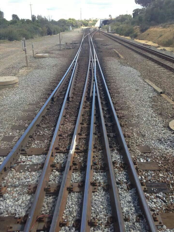
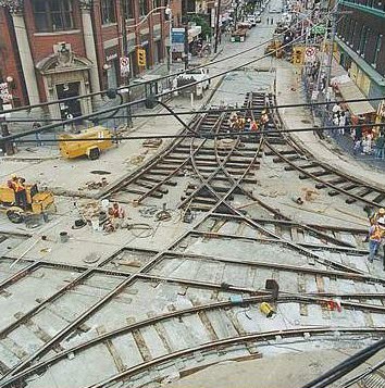
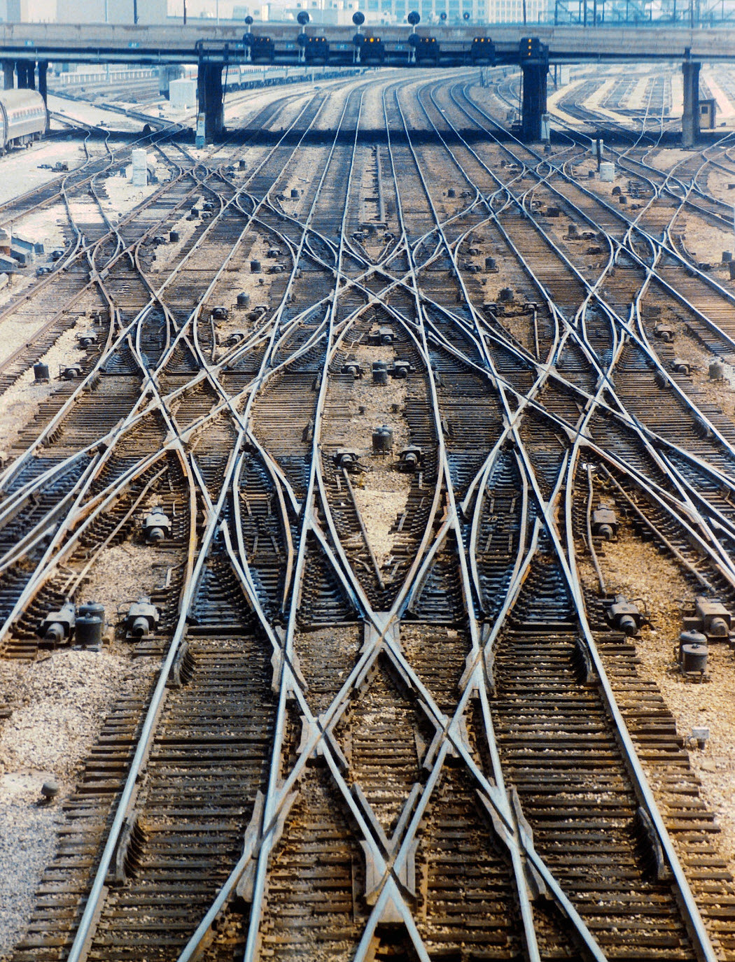
For this page, it's two pictures that crossed my path..... One was a picture from ZOO Interlocking in Philadelphia, and the other was a photo of (probably) triple gauge track that the common guess for it's origination was Australia. Not. Here they are:
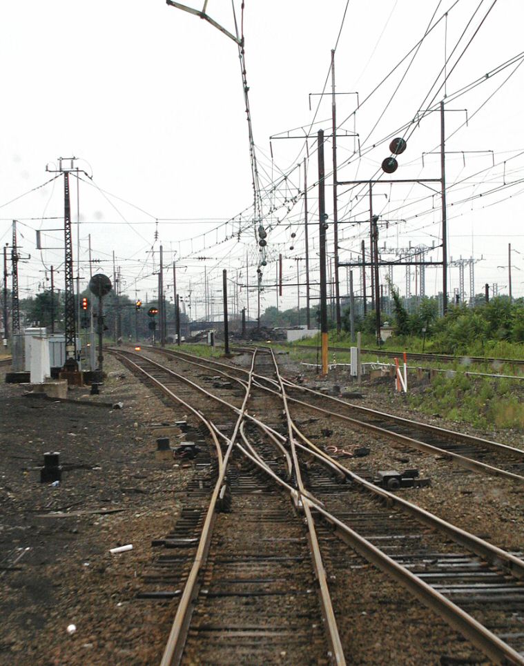
In the picture above, we have a pair of double-slip switches under catenary, with Pennsy PL signals all over the place. There just are not that many places in the U.S. that you will find this combination, so I started with Philly, because I knew it was not Baltimore or Washington DC. I started looking for places with a sub-station next to the tracks - the towers in the background on the right. The other item were the two double-slip switches, which, BTW, are both gone. For more information on the picture, the double-slips, and the signals, click here.
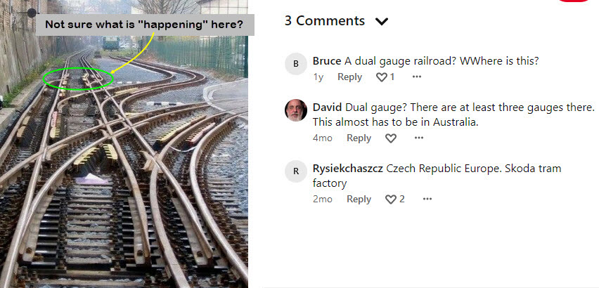
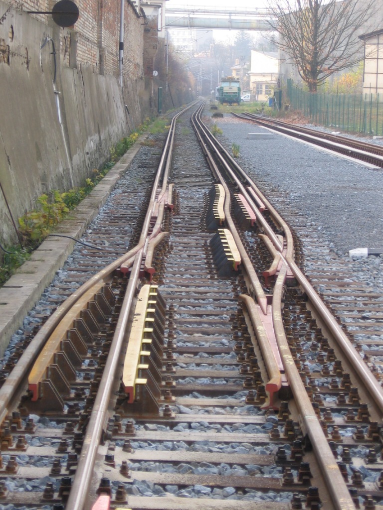
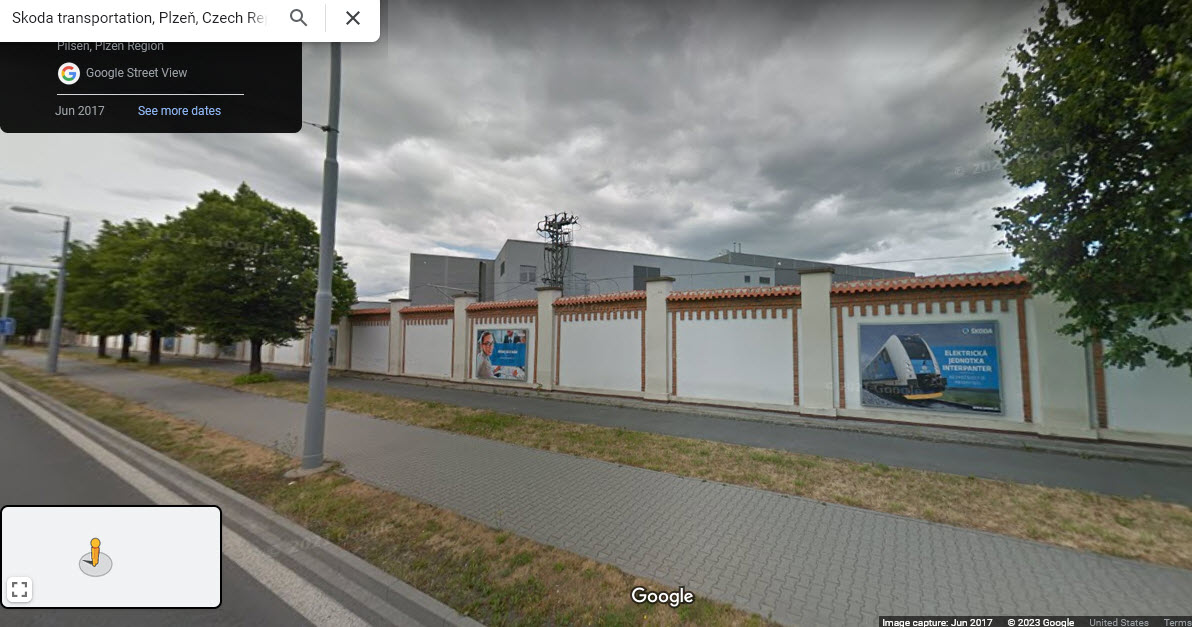
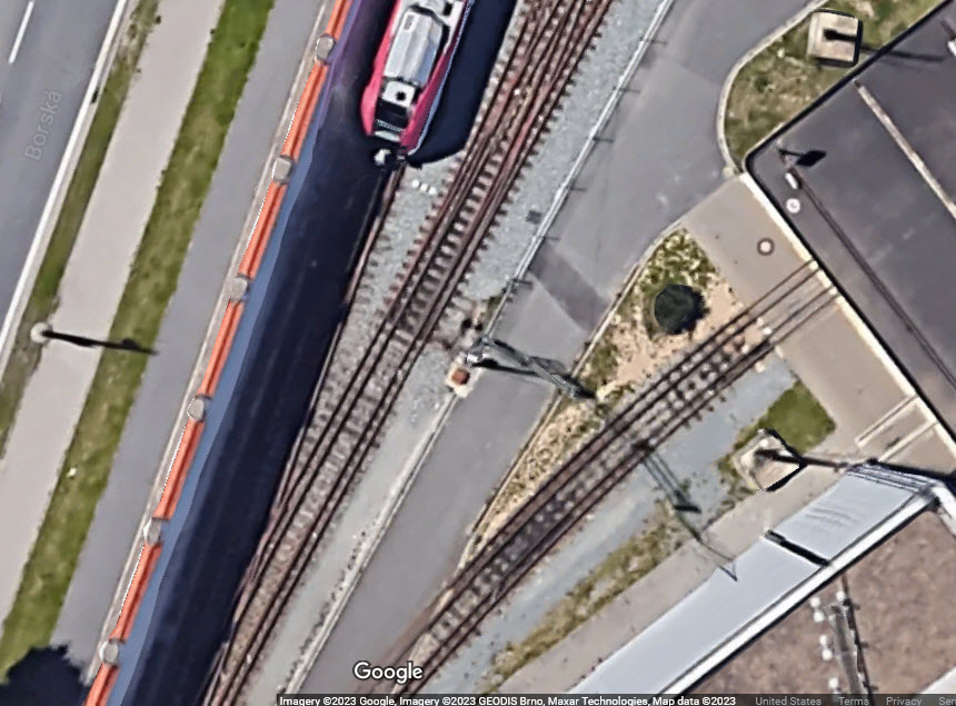
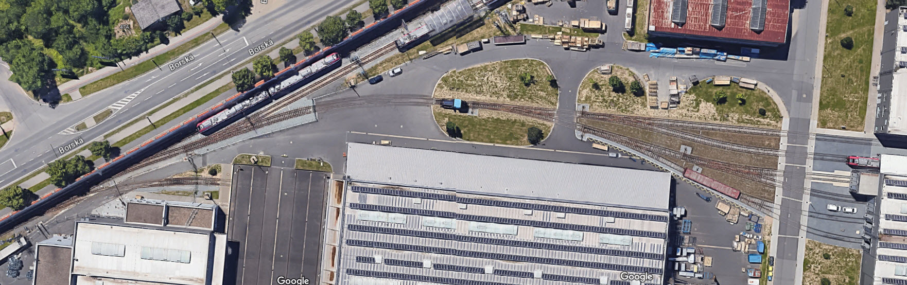
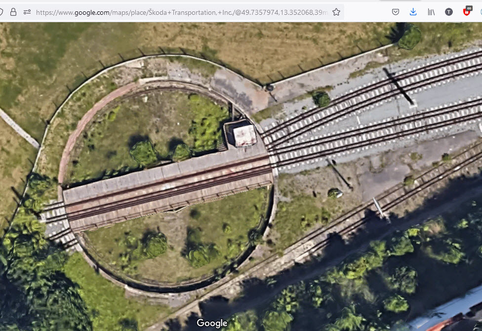
With the picture below, it has shown up all over the place, and as I said, most people guessed it was in Australia because of the multiple gauges. Then, I "found" the picture on Pinterest, and the third comment sent me off on a quest. It took me to the Skoda Transportation factory in Pleziri, Czech Republic. Although the track arrangement has changed, probably because of a shift in their production line, there are still two gauges in a small section of the property, and it even includes a three gauge turntable. If it wasn't for the comment by Rysiekchaszcz, we would probably still be wondering where the location is. In the pictures of the factory below, I wish the satellite photo was taken earlier in the day, as the shadow from the wall makes it difficult to see much of the detail.
Acknowledgements:
Jim Mihalek
Rysiekchaszcz
Kevin Mueller
Paul Benton
Jacqui Stanley
Murray Liston
Bruce Feld
Denver Todd
Flickr
chaski.org
Shingo
BRO1TT
Marcel Ackle
earthmagnified
Flickr
Pintrest
Google Maps
Bing Maps
Open Railway Map
Wikipedia
Websites and other additional information sources of interest for the area:
https://www.flickriver.com/groups/1364051@N20/pool/interesting/ Narrow gauge railroads
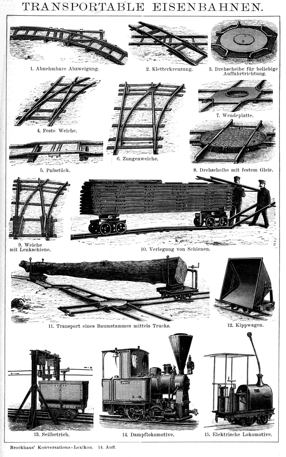
https://www.schienenlasche.de/Feldbahn/Andere/Wurzach.html German narrow gauge mining railroad and excursion train
https://en.m.wikipedia.org/wiki/Dual_gauge#
Pictures
Pictures without a comment or location - nothing is known about where or what....
Trackwork in Australia
Forrestfield WA Australia
 Paul Benton/Pinterest
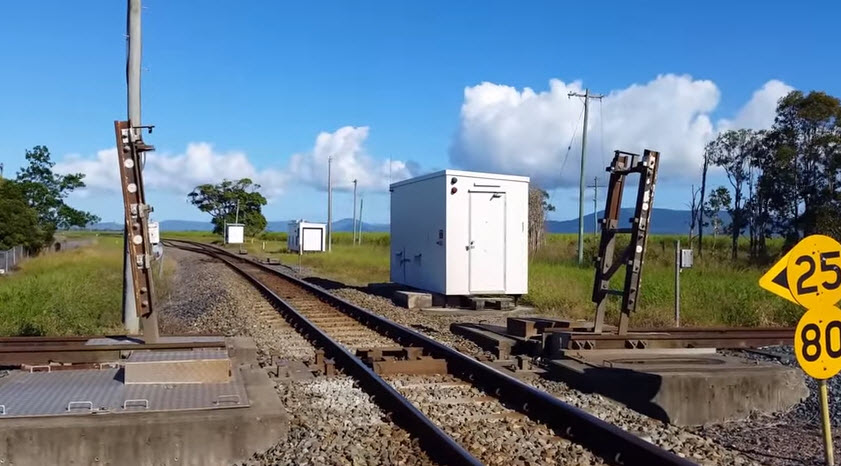
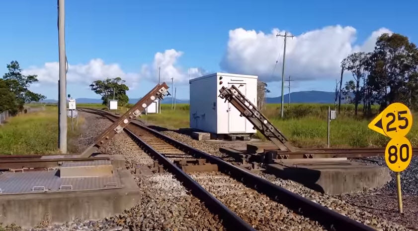
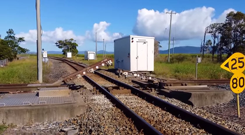
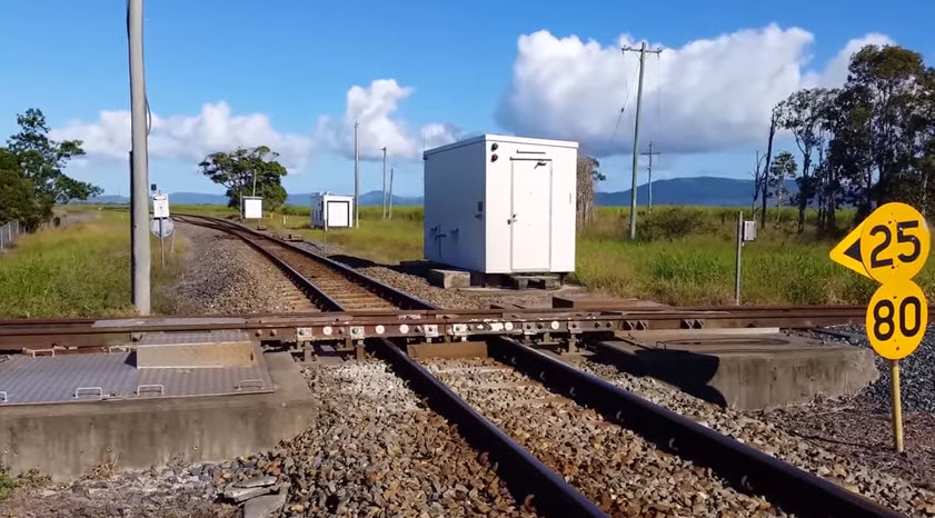
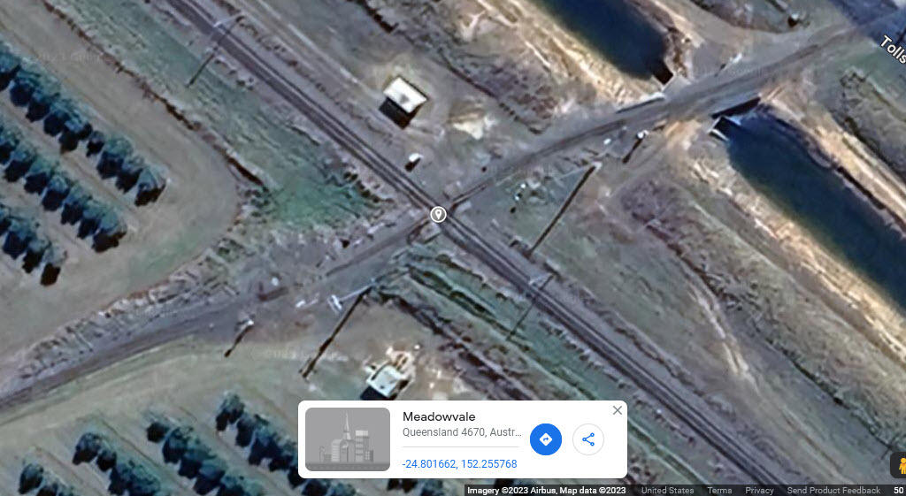
Queensland Australia
GPS Coordinates: -24.80166, 152.25577
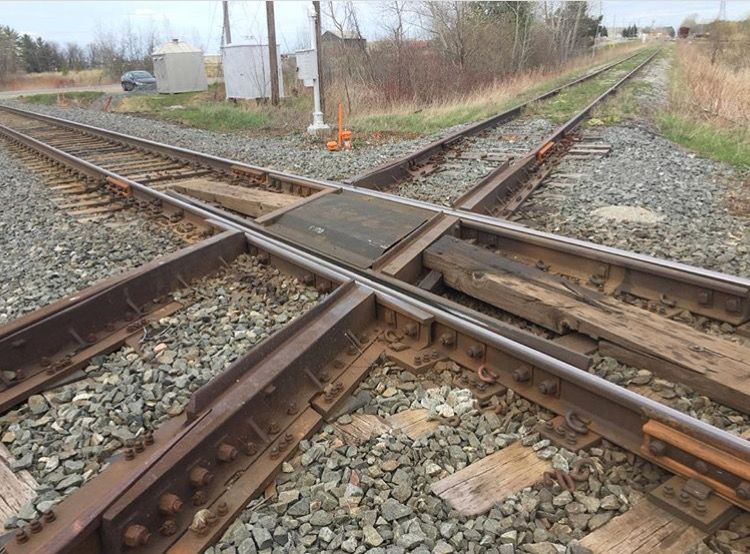
Gotta love Pintrest, I come across so many of the things on this page because of their feeds :-) This is a railroad crossing between a standard rail line, and a narrow gauge track. I wish the video had a narrow gauge train going over the crossing! Screen shots are from the video.
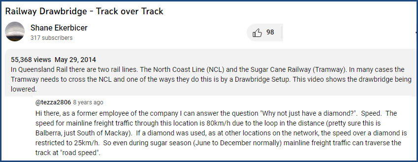
A video of the narrow gauge tracks coming down is here: https://www.youtube.com/watch?v=P1zyUnoPhFU
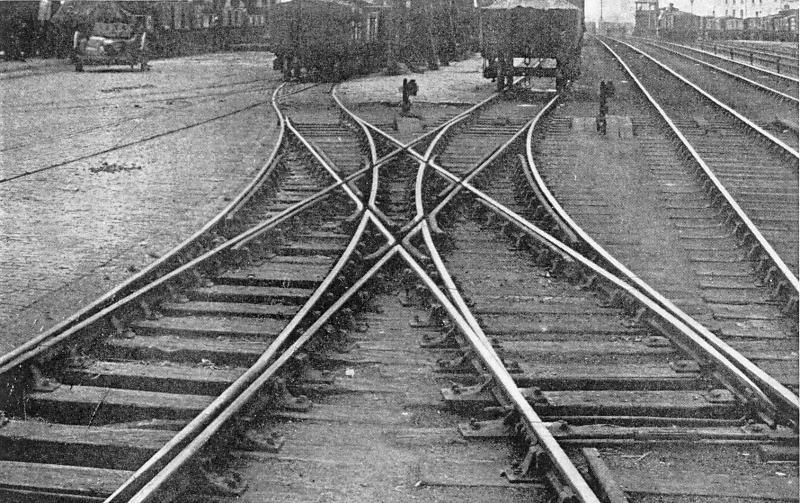
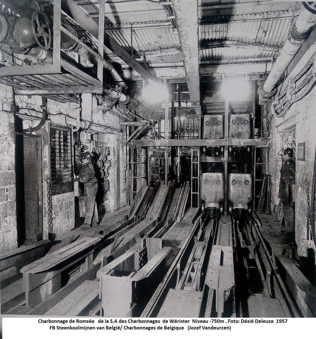
Trackwork in Belgium
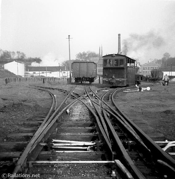
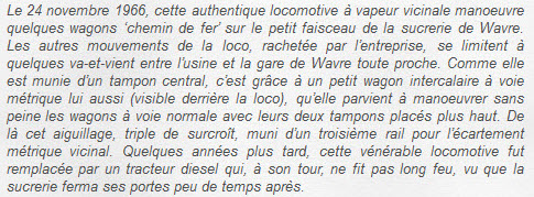
Wavre Belgium (I think), 1966... the steamer looks to be narrow gauge, the wagon is wide gauge.
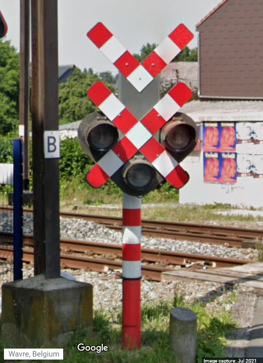
A current day grade crossing signal in Wavre, no signs of track other than the commuter line can be seen on Google Maps.
(The 60's - What an interesting time period, "we" had just moved to Baltimore MD)
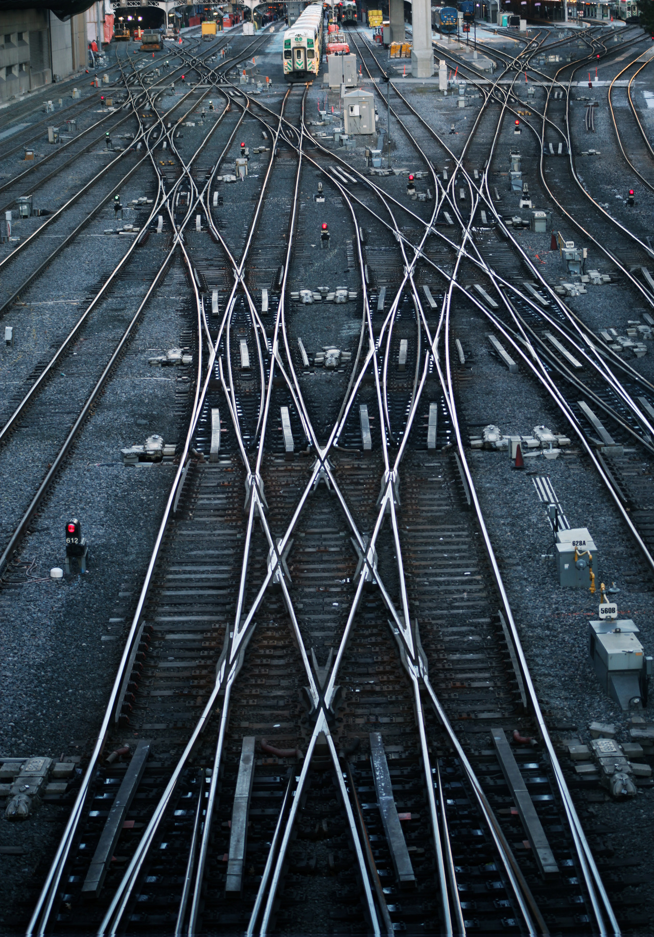
Trackwork in Canada
Toronto Union Terminal
Not identified as such, however, with the GO trains, where else?
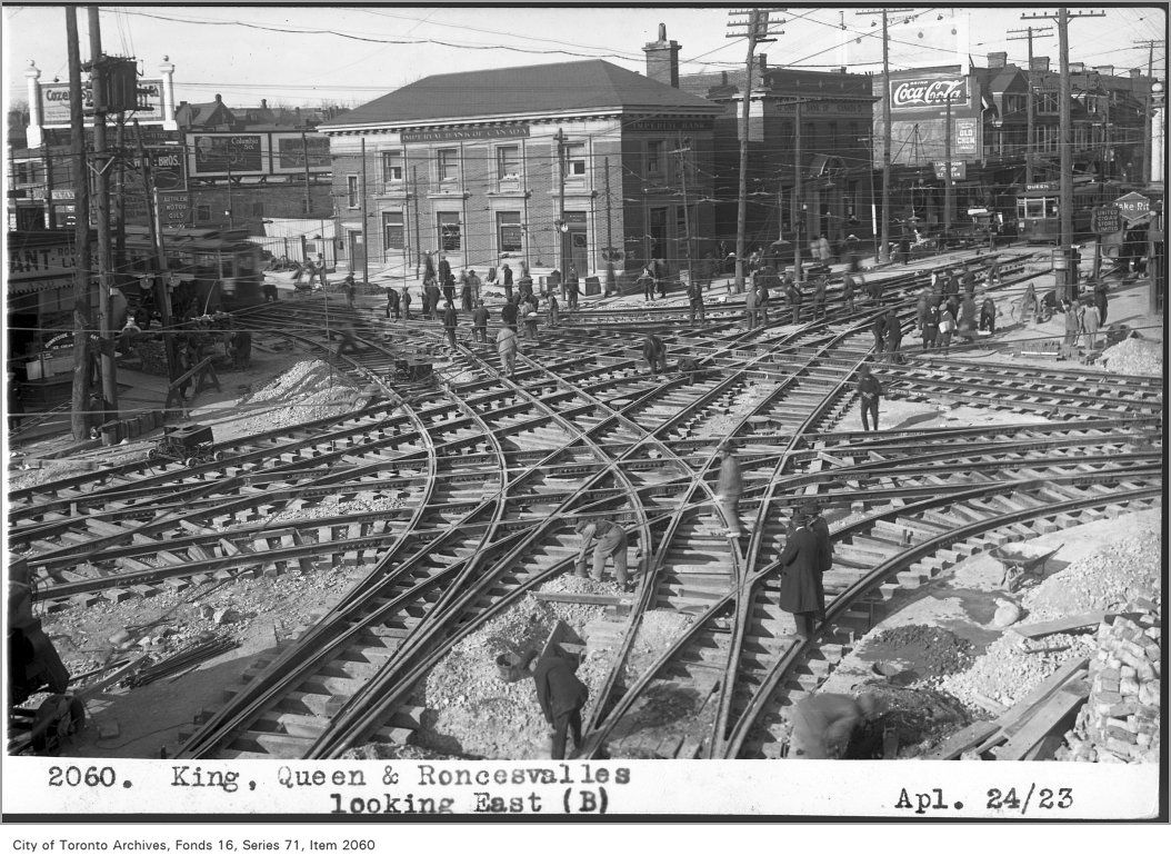
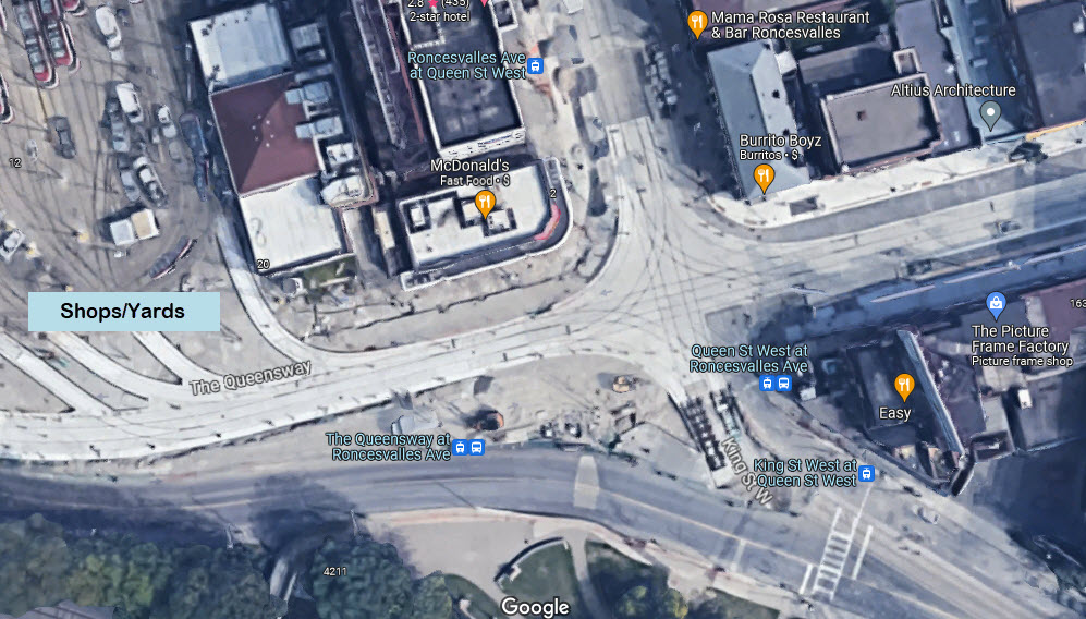
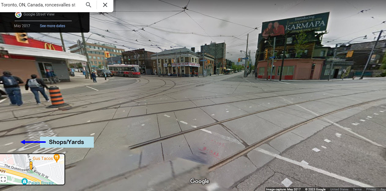
Toronto Streetcar
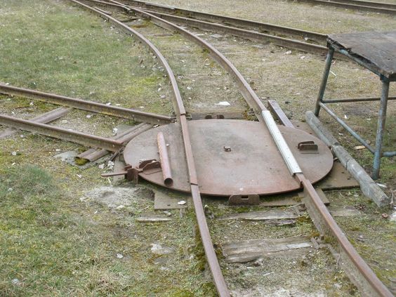
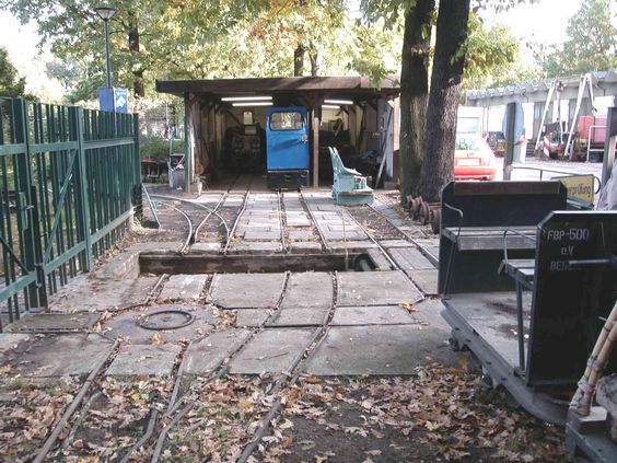
Trackwork in The Czech Republic
At the Skoda factory in Plezn
More pictures of the multi-multi gauge track there.
 Would be cool to have this in my backyard :-)
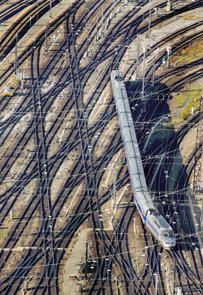
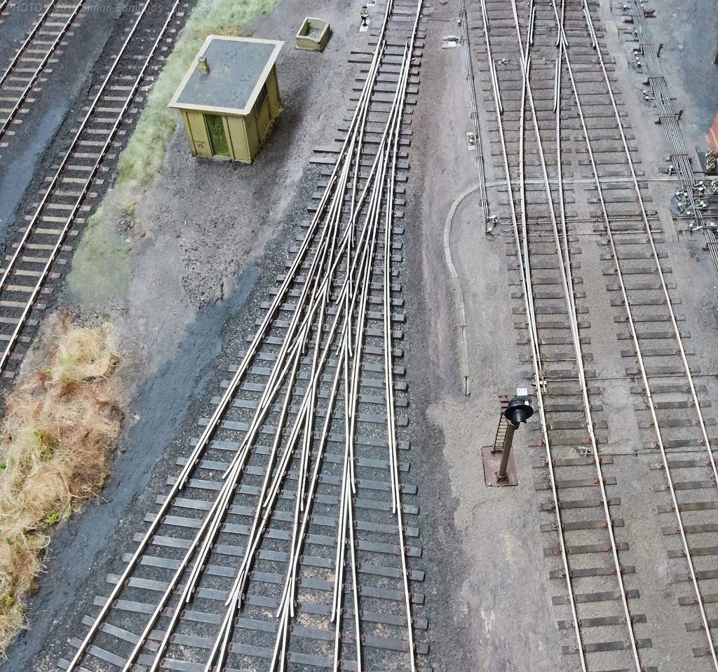
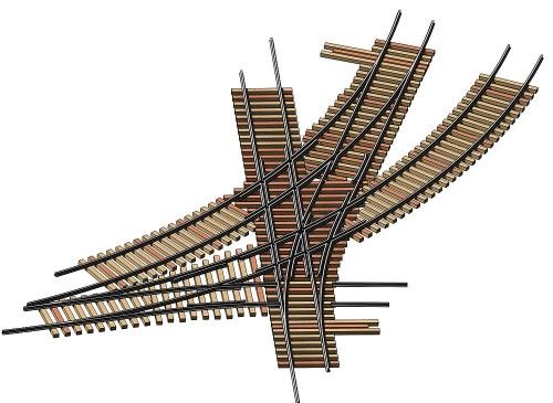
This isn't real, it's on a model Railroad pike somewhere, but you gotta give the guy who did this a big cheer.... lotsa detail work and patience!
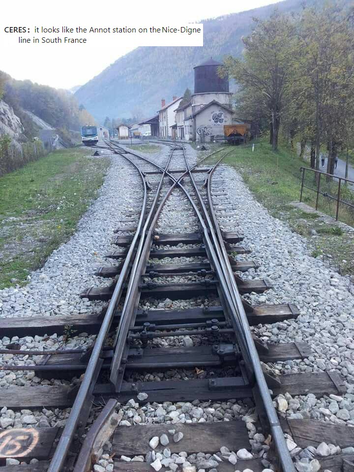
Trackwork in France
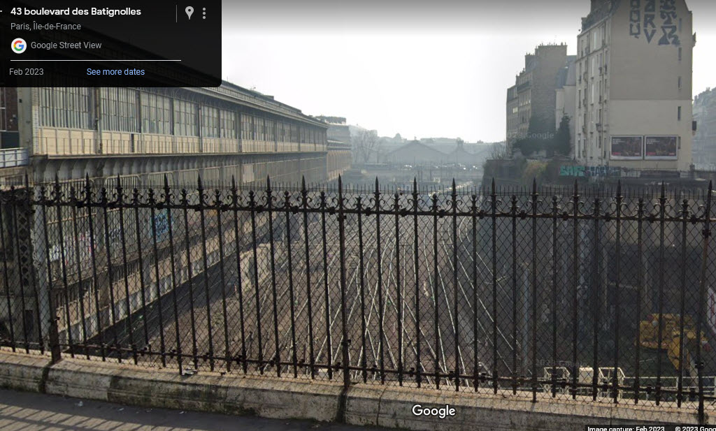
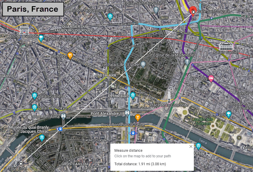
Paris, Gare Saint-Lazare
This station is 1.9 miles / 3km north-east from the Tour Eiffel.
 Picture from 1934, by Ergy Landau?
Found here: https://www.bloglovin.com/blogs/art-deco-2621251/undr-ergy-landau-gare-saint-lazare-1934-5921447943
This is probably where the picture was taken from, judging from the building on the left! :-) From what I can see, it doesn't look like the trackwork has changed a whole lot in almost 100 years!!! Maybe someone can take a picture from there and send it in???
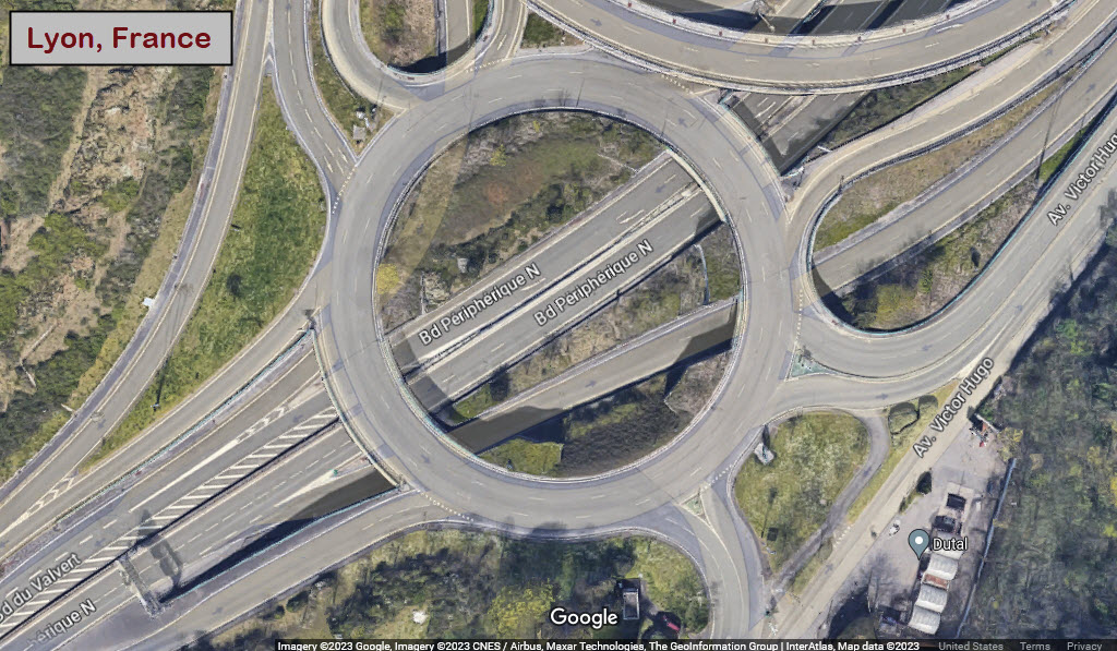
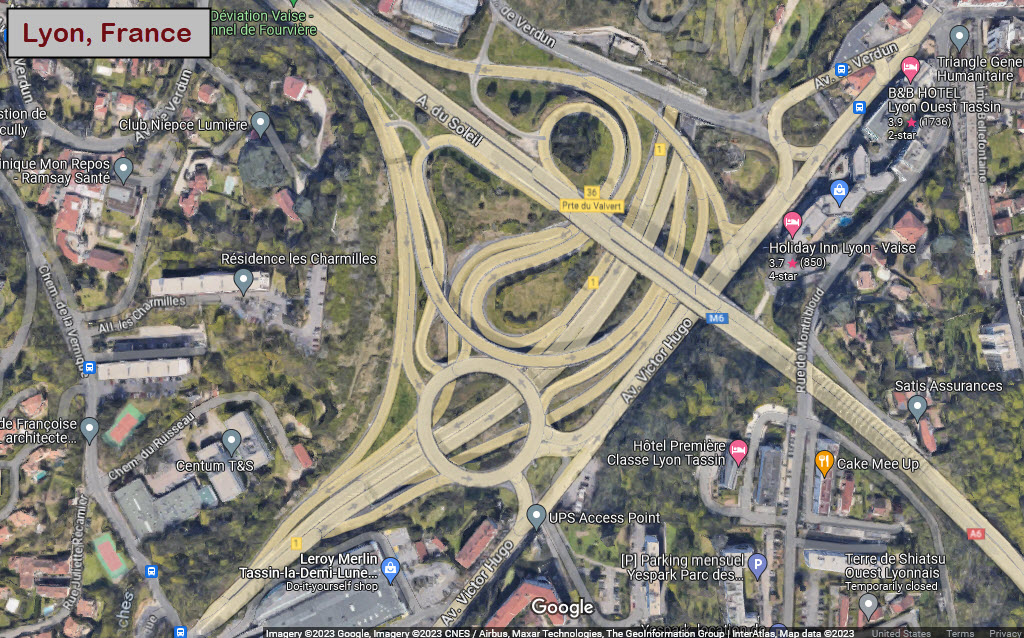
Lyon
Lyon is an excellent railroad town, but the most interesting thing I came across, at least via aerial pictures on Google Maps, is this highway interchange....
Elsewhere in France
 In France or Belgium...
Trackwork in Germany
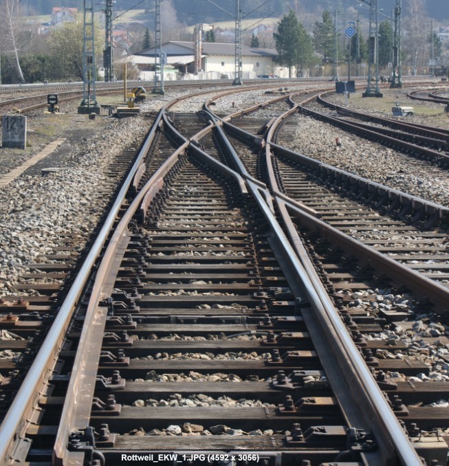 Somewhere in Germany....
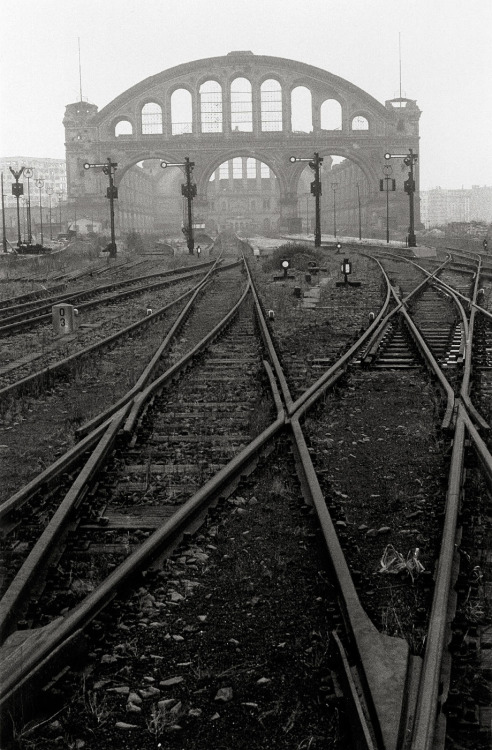
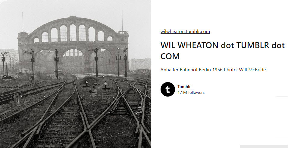
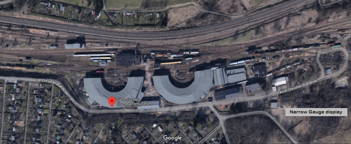
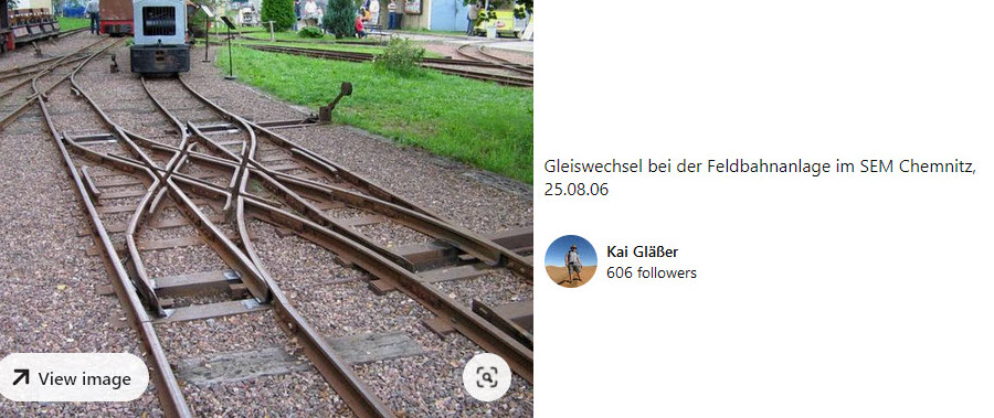
Saxon Railway Museum
An d. Dresdner Bahnlinie 130c, 09131 Chemnitz, Germany
GPS Coordinates: 50.86174, 12.96653
In Google's aerial view of the museum, you can just barely make-out the narrow gauge mining railroad display, over on Bing Maps, forget it...
On Google, the museum seems to garner a lot of good reviews, citing the largest steam engine inventory in Germany, and one guy said it was the best out of six railroad museums he visited. Features two large roundhouses.
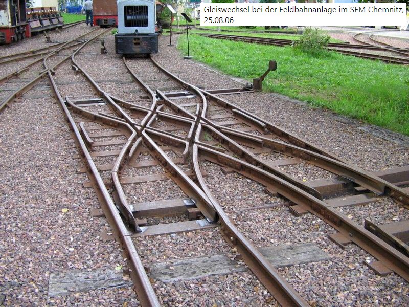 This is the photo that started "it", the mining RR display....
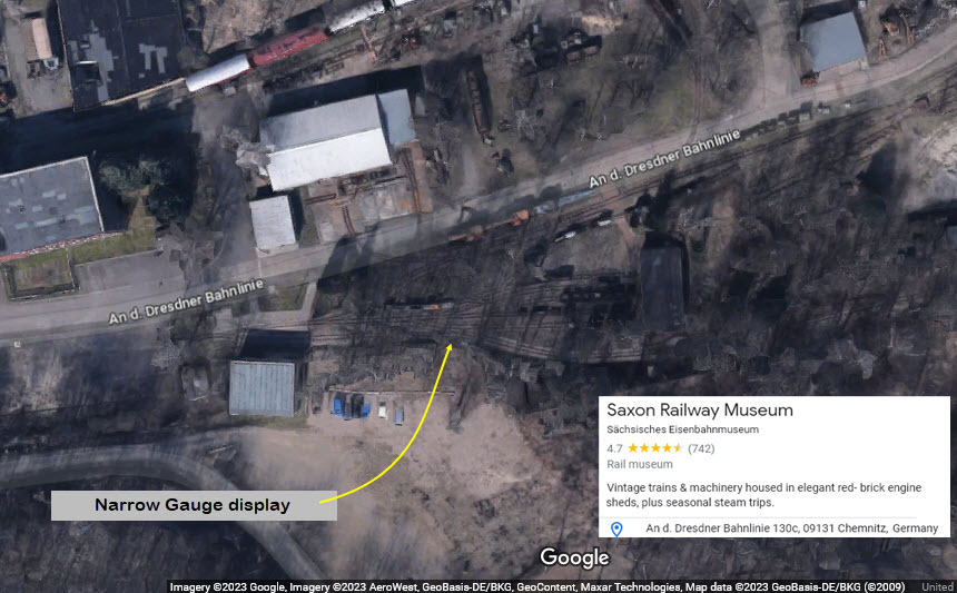
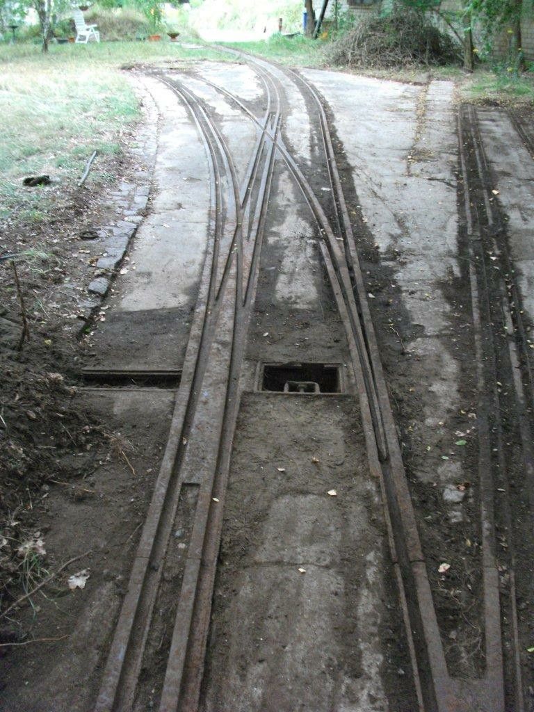
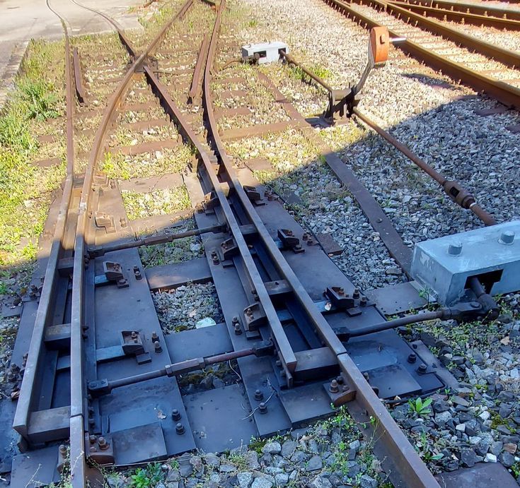
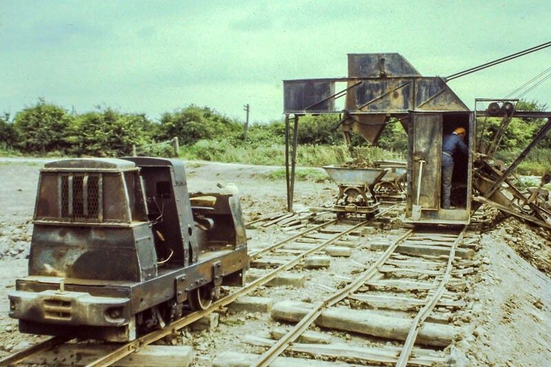
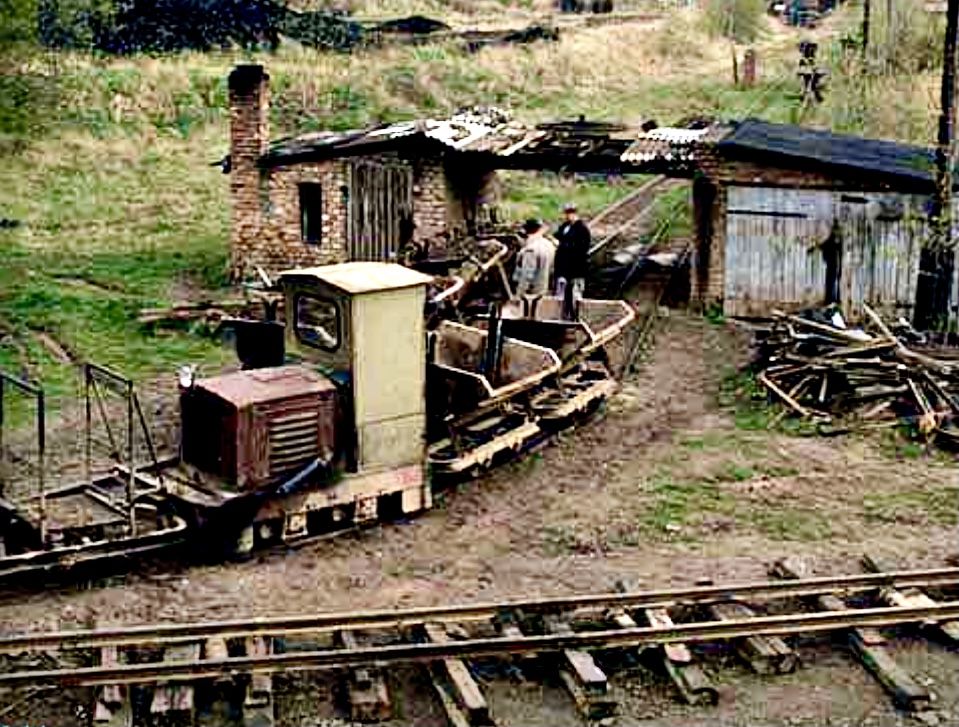
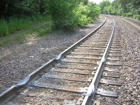
Mining or Small Industrial Railroad
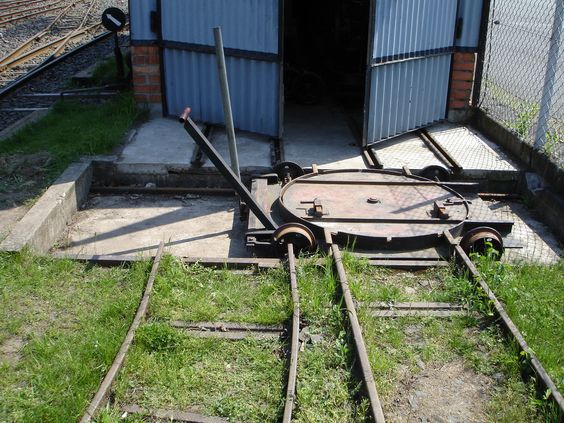
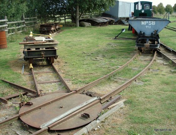
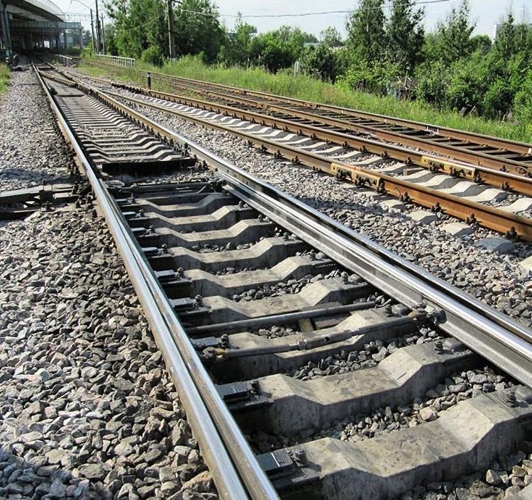
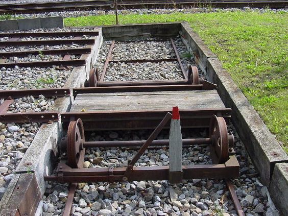
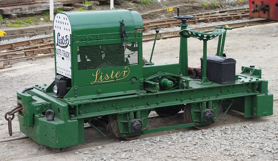
I dunno, there is something about this trackwork that is really appealing, maybe because it's something like "I" would do in my backyard :-) :-) Again, this stuff popped up in one of my Pinterest feeds...... The metal ties in the pictures are similar to those shown in the advertisement! Looks like most of these were posted to Pinterest by Marcel Ackle. Thanks! The pair of pictures of the turntable - looks like it is the same turntable, on maybe two different visits?


Trackwork in Greece
Megalo Livadi, Serifos Island, Greece
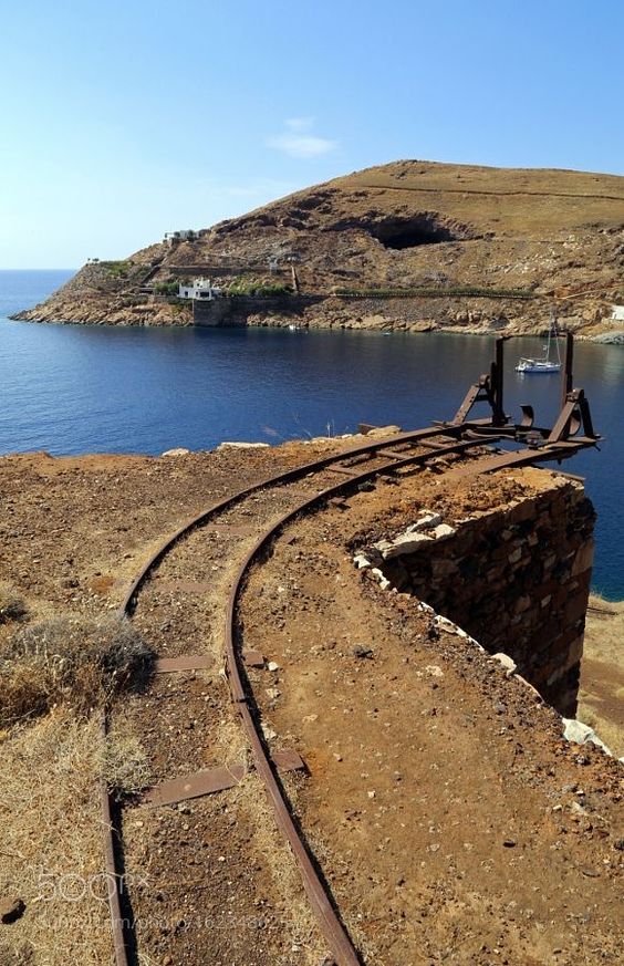
 Not really multi-gauge, but....
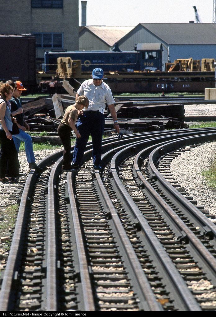
Must be a major pain-in-the-ass to maintain the gauge around that curve, huh? :-)
Dunno where this is, but it almost looks like it is in someone's backyard, huh? :-)
Stub switch, and it looks like the frog rotates
A three-way wye switch!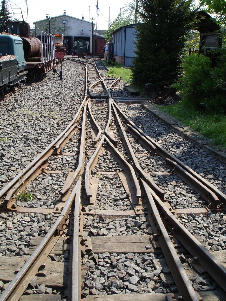
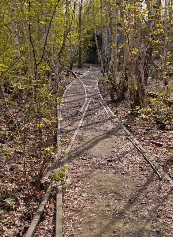
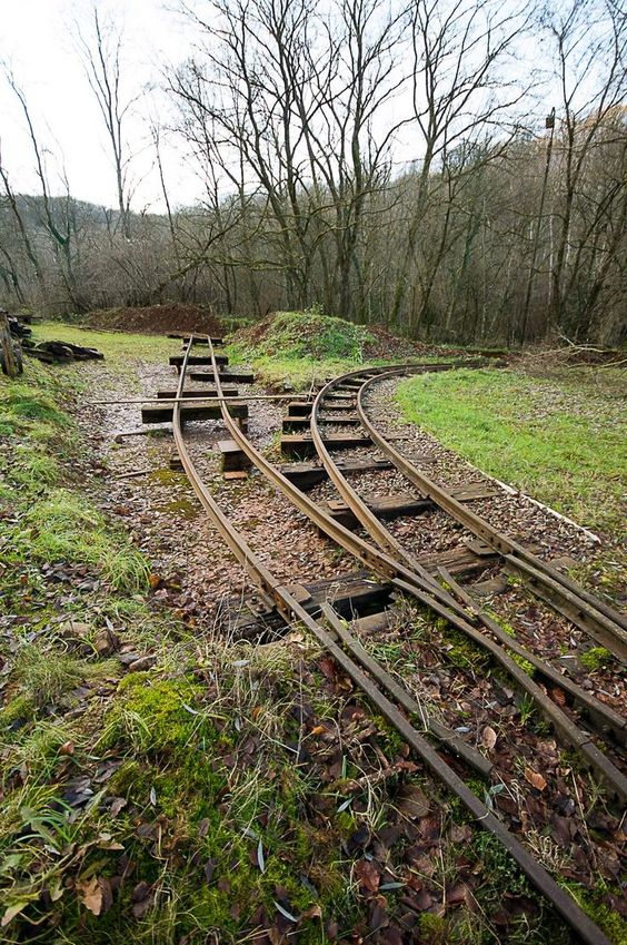 Abandoned mining railroads are always interesting!
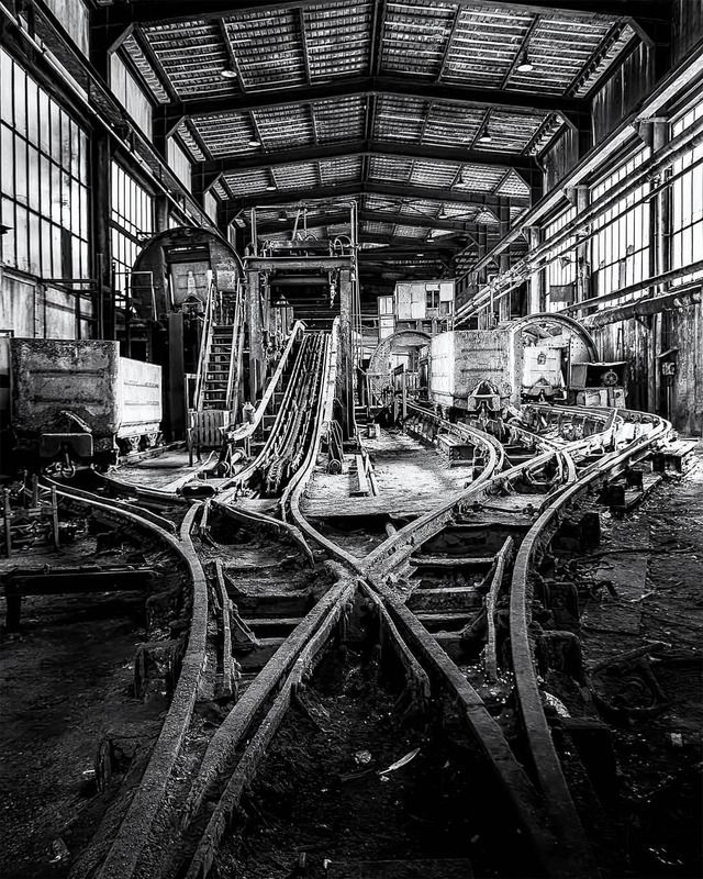
It is always interesting to see what narrow gauge operators did and didn't do with their tracks to keep costs to a minimum! :-) :-)
 Marcel Ackle via Pinterest
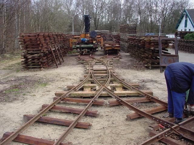 Marcel Ackle via Pinterest
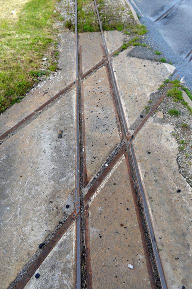
Probably somewhere in France, because of where I found it: http://aubertrain.com/amtp.html
Trackwork in Japan
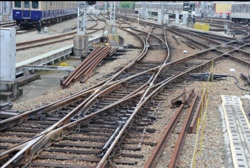
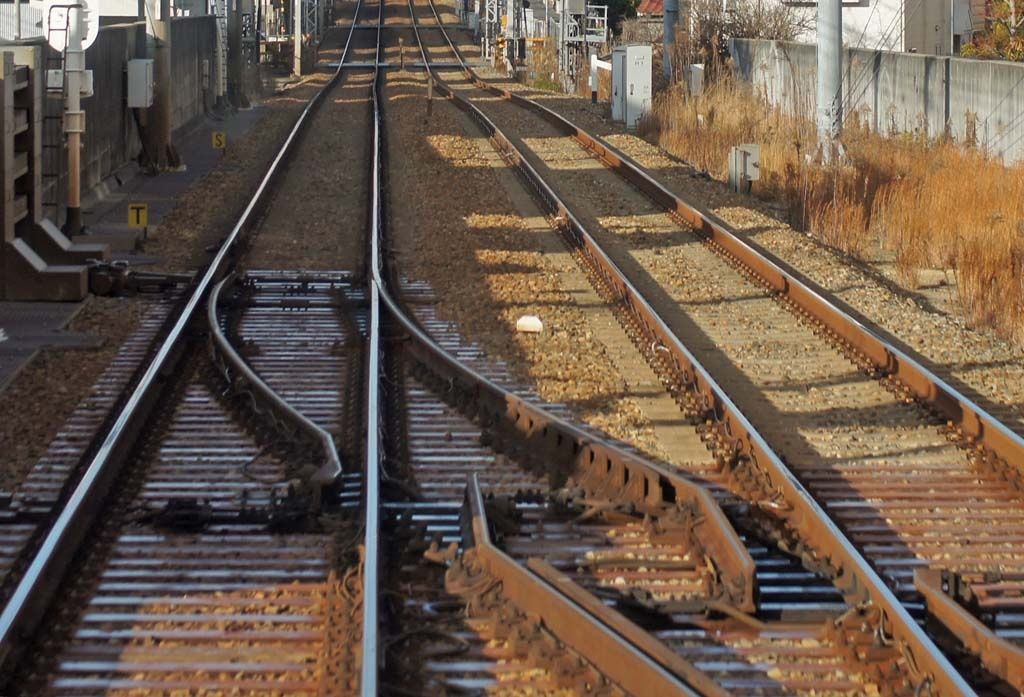
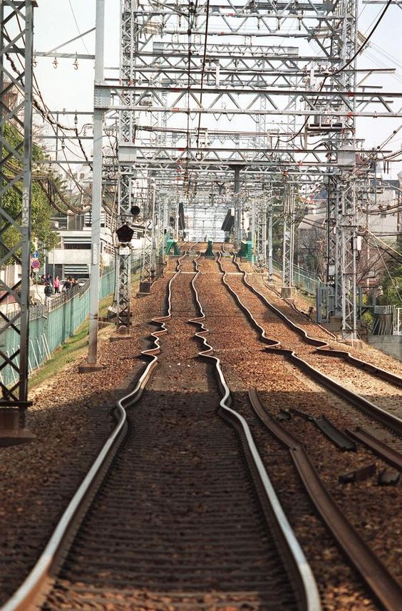 After an earthquake in Japan
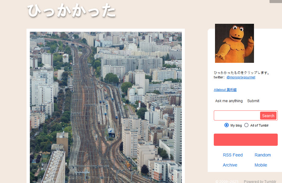
Trackwork at Unidentified Locations
 ooooooops!
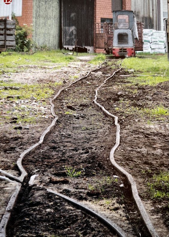 How do rails get bent out of shape like that?????
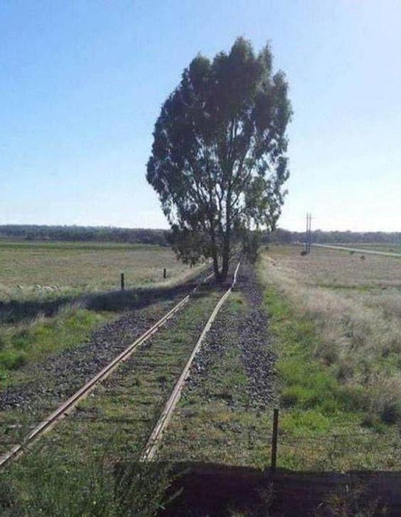 It's been a few years....
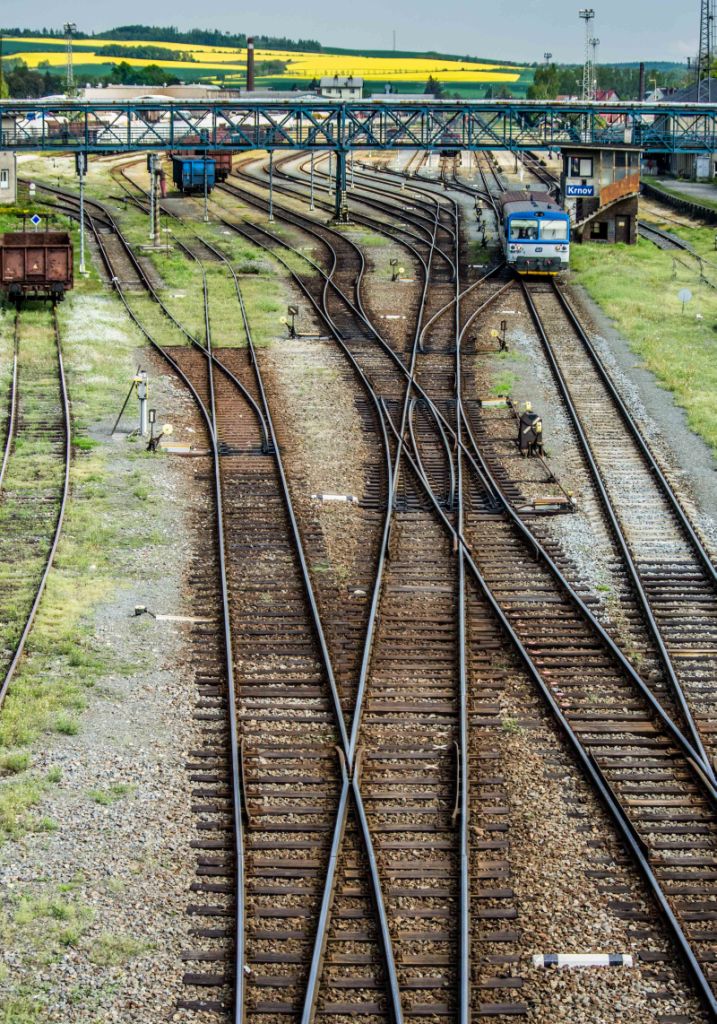
Many diamonds in the United States are now being configured like this, where the lower usage track is slightly elevated, and the flanges ride over the main track. This keeps the "main" track from having cuts in the rail.
WTF? And where? photo by Shingo.
Looks like it may be one of those places where the connecting track rides over the main track with the wheels riding on their flanges.
 Just plain old interesting....
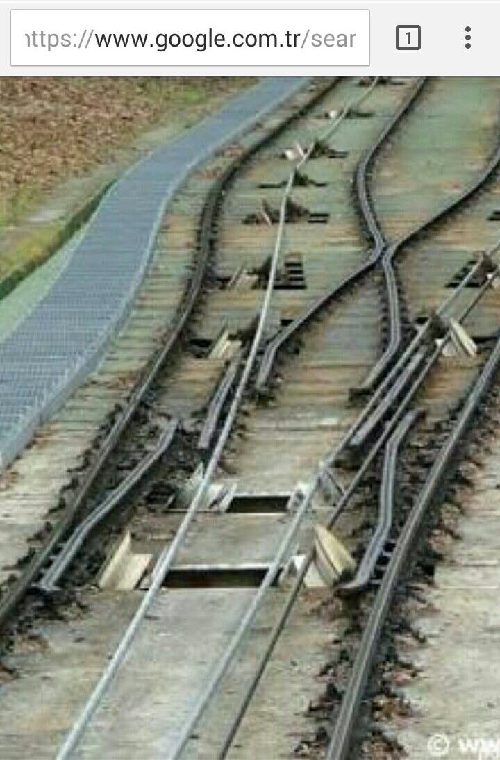 I wish the rest of the address was up there....
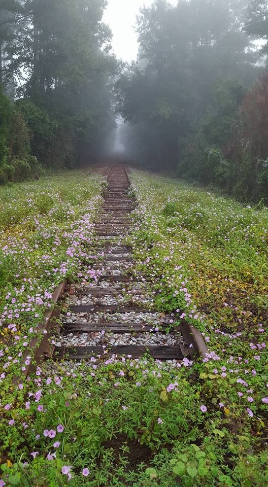 Angelfire
Trackwork in Poland
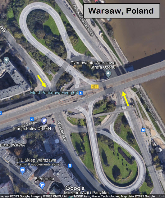
Warsaw? Maybe?
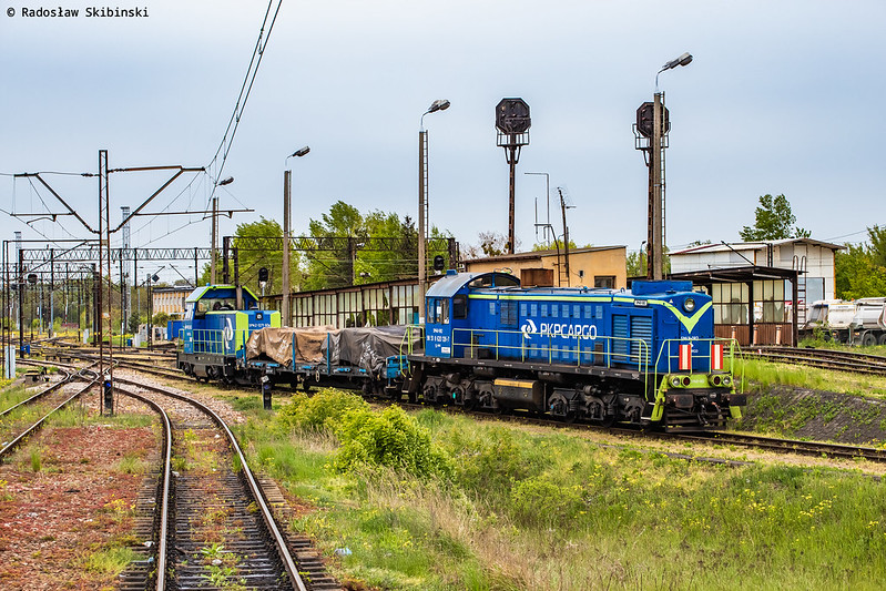 Maybe
Mr. Skibinski can write in and tell us where this is?
Maybe
Mr. Skibinski can write in and tell us where this is?I also love interesting highway interchanges, so while I was cruising around the Warsaw area, I happened across this:
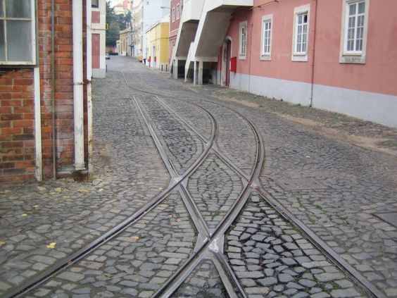
Trackwork in Portugal
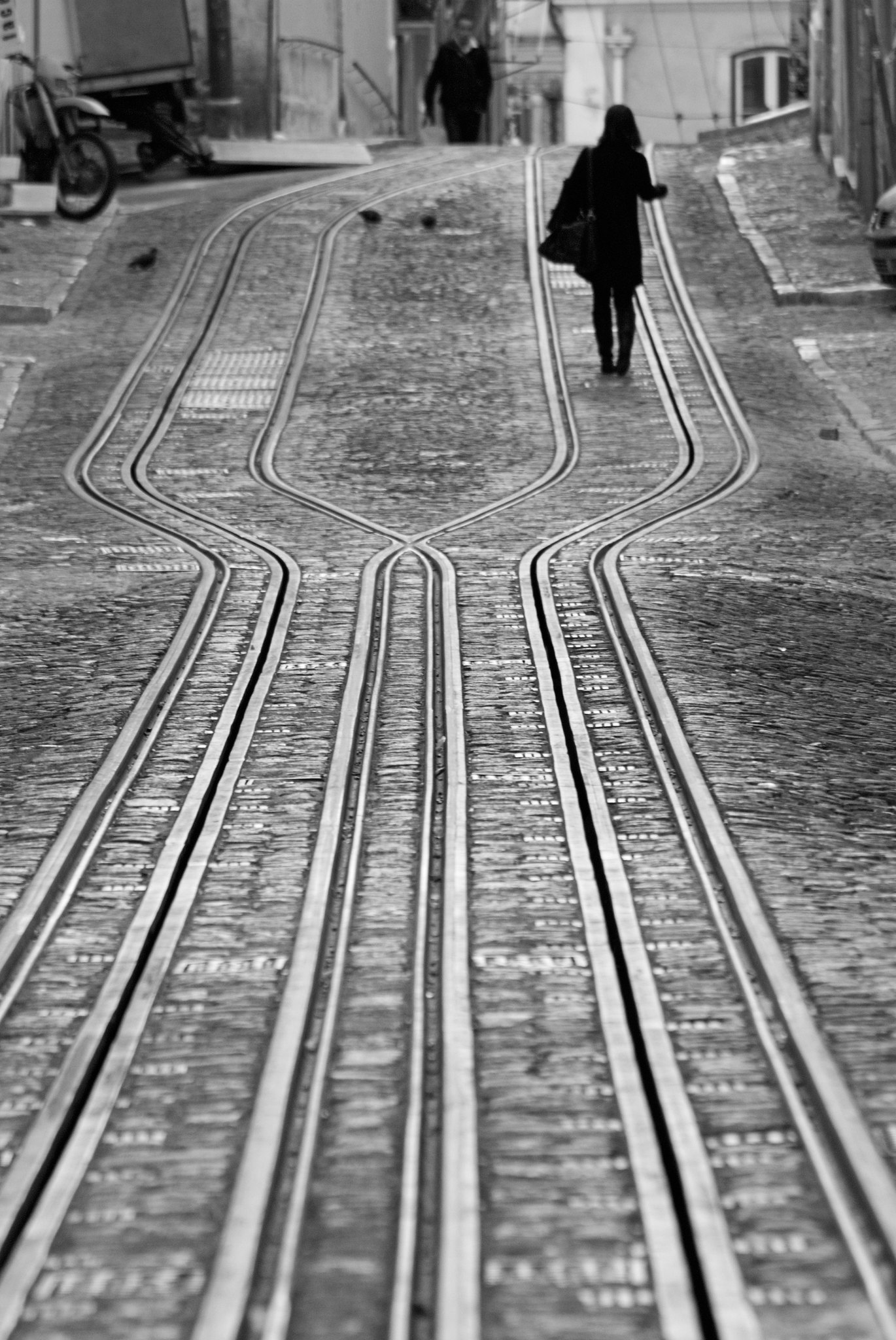 Lisboa, Portugal, Andres Garcia, 2011
Trackwork in Switzerland
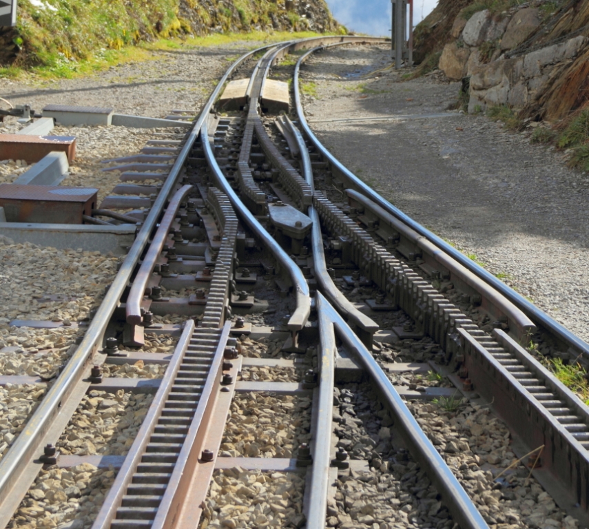
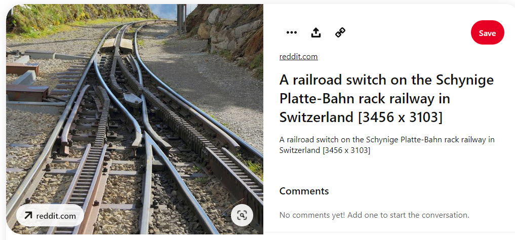
At A Mining Museum?
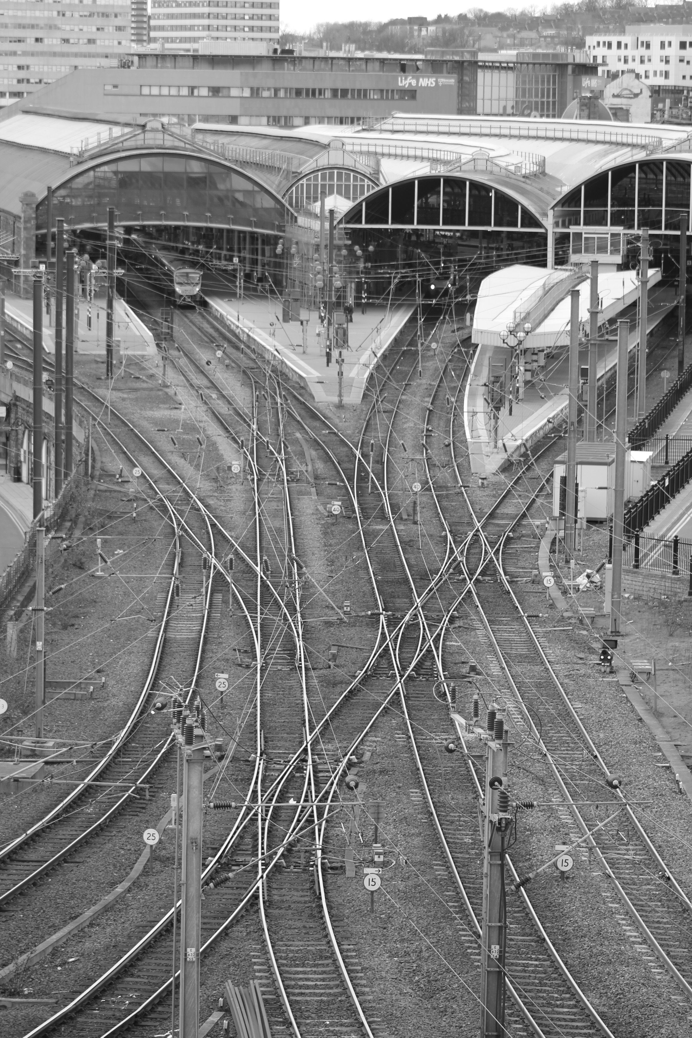
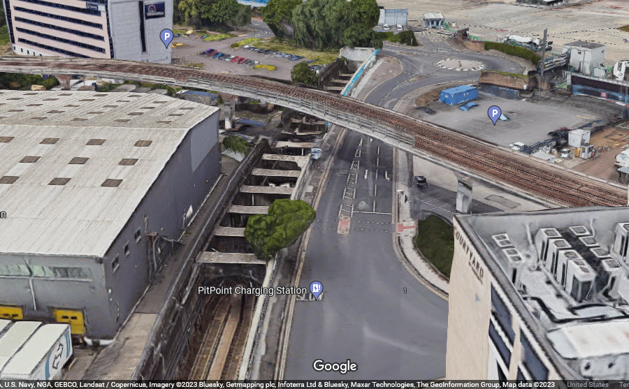
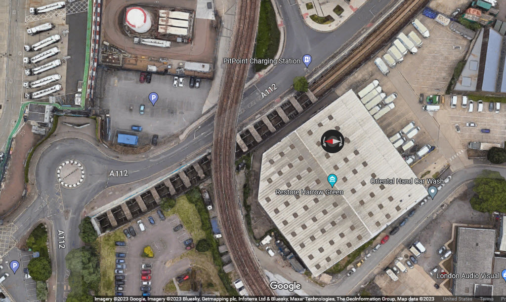
Trackwork in The United Kingdom
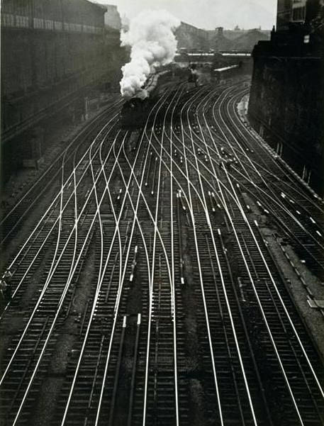
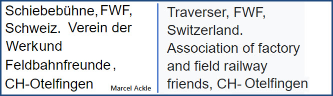
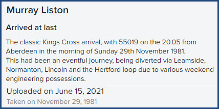
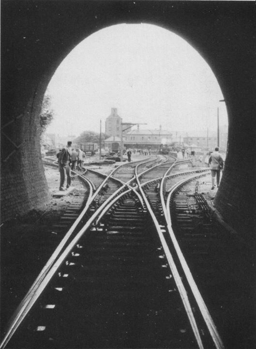
Newcastle
For some reason, pictures of Newcastle seem to keep popping up! :-) I love those "old" British diesels!

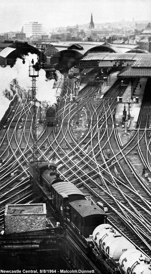
Newcastle Railway Station, 238 miles north of London, Samantha Willoughby
https://en.wikipedia.org/wiki/Newcastle_railway_station
 Jacqui Stanley,
https://www.flickr.com/photos/jaxstanley/
Jacqui Stanley,
https://www.flickr.com/photos/jaxstanley/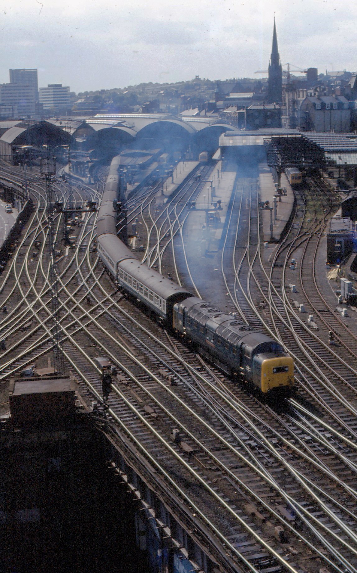
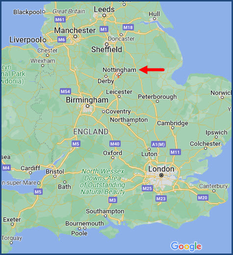
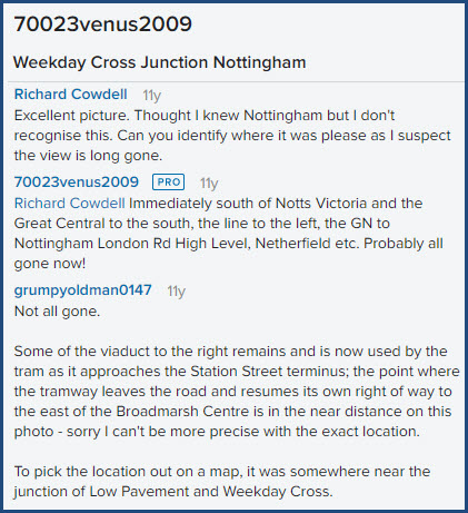
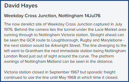
Nottingham
https://www.flickr.com/photos/davidhayes/11628889665/
https://www.google.com/maps/search/Broadmarsh+Centre,+Nottingham,+UK/@52.9509026,-1.1455334,101m/data=!3m1!1e3?entry=ttu
GPS: 52.95093, -1.14595
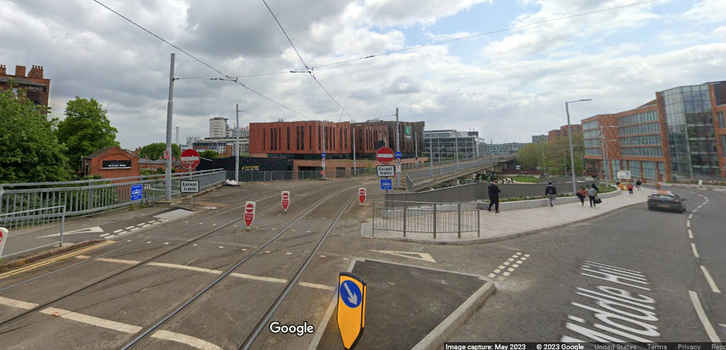
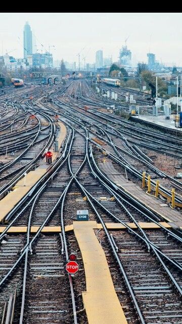
I've always enjoyed the fact that I grew up in the U.S., and especially my time in New York City sitting right next to the New Haven line as it makes it's way to Hell Gate Bridge, but when I see pictures of what railfans in the U.K. had available to them during the 1960's, it seems almost pale by comparison. Unlike America, the railroads, even in the latter half of the 1800's, had to snake their way thru many towns because they were well developed (and dense). America in contrast, was young, and most urban areas were not very well developed, so they had room to accommodate railroads as they were built. In the picture below, I betcha even back then, they had to tear down a whole lotta "older" buildings as they built the two viaducts. It's too bad they couldn't have used the entire original viaduct for the tram.
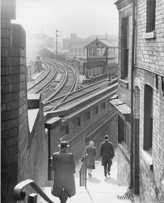
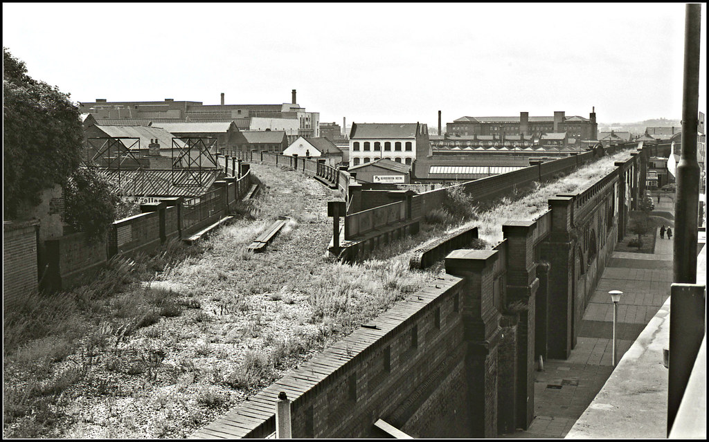
In the combined picture below is where I believe this junction WAS.
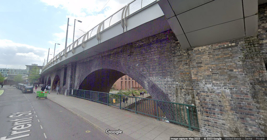
It has been noted on Google Maps that part of the tram uses the old Victorian viaduct along Trent St, seen in the bottom picture.
Keep in mind that the railfan comments are from 2012.....
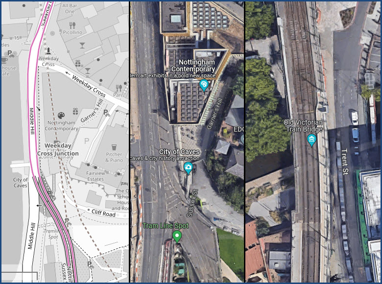
The view today, from roughly the same spot (I believe).... nothing recognizable anymore. And part of the Victorian viaduct.
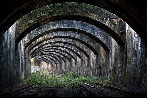
Silvertown
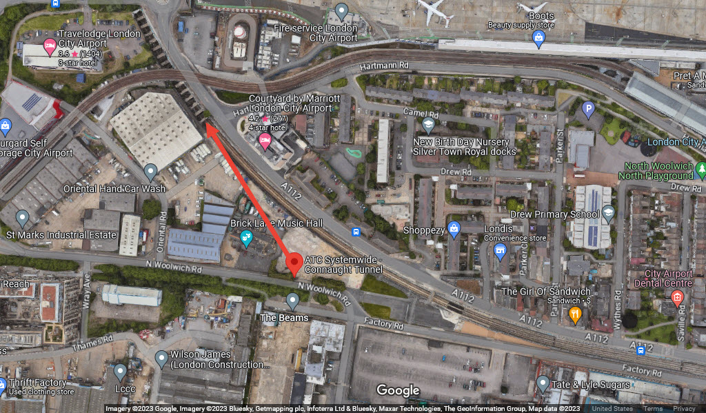
Connaught Rail Tunnel, 2010
Google GPS Coordinates: 51.50399, 0.04187
So, there are two parts to this tunnel, one on the north side of the (no-named) inlet, and one on the south side. The tunnel is now used by the DLR - Docland Light Rail.
https://bregroup.com/case-studies/ceequal-case-studies/crossrail-connaught-tunnel-and-surface-railway/
Elsewhere Around the U.K.
 London?
Or Jamaica, Long Island?
London?
Or Jamaica, Long Island? Buttery
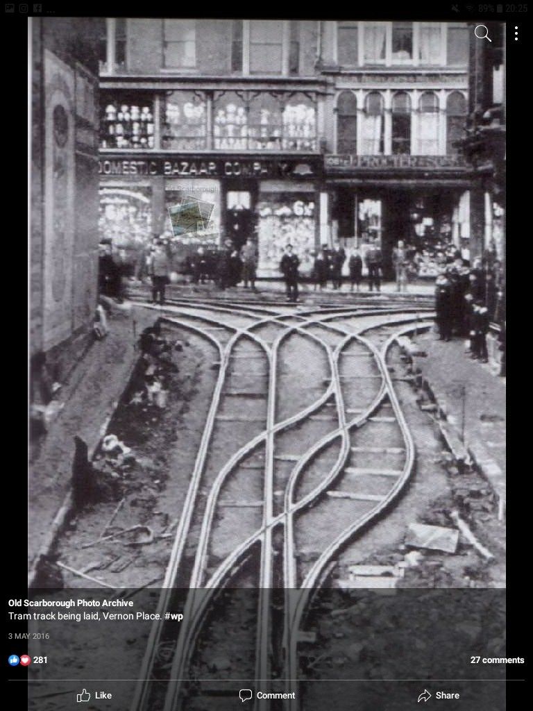
 Kempton UK
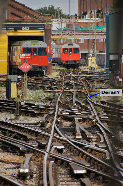
London Underground, may be near the Hammersmith station, but definitely looks like it is in a maintenance yard.
For those of you not familiar with the "Lionel like" forth rail in the middle, that is the return for the DC power - they do not rely on the two outside tracks the wheels ride on for the power return.
 Beautiful!!!
Trackwork in The United States
Chicago IL, USA: the Chicago EL
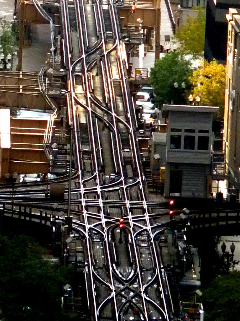
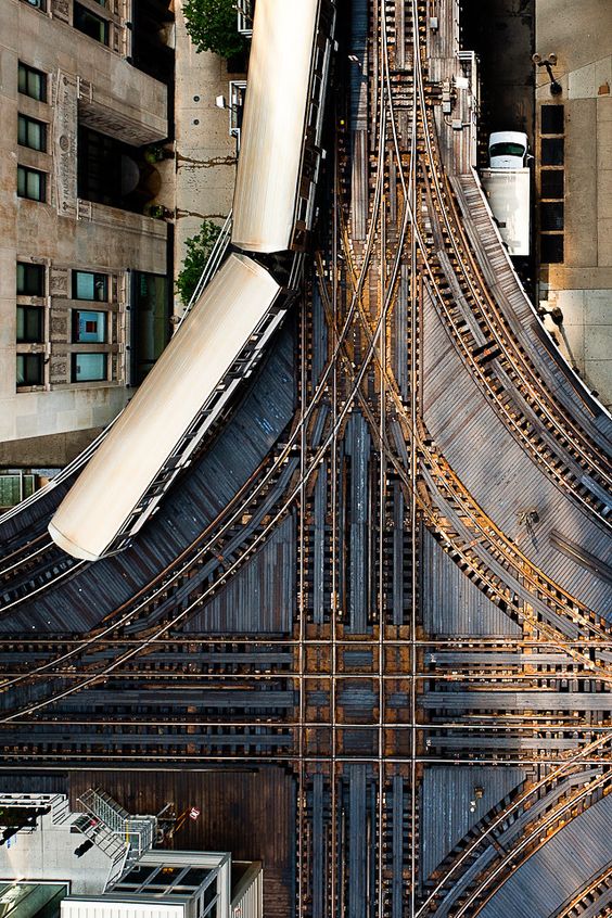
Chicago IL, USA: the Chicago Union Terminal
Double slip switches at Chicago Union Terminal, when they were in process of replacing the Pennsy signals with "trilight" style colorlight signals.
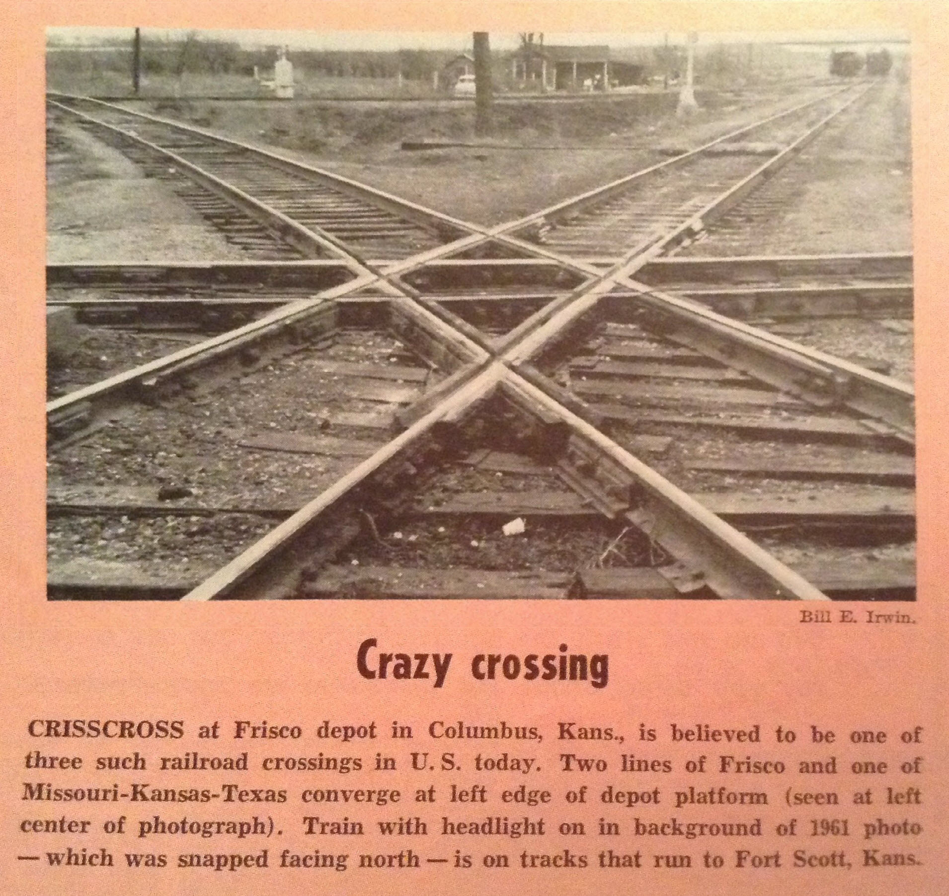
Columbus KS, USA
GPS Coordinates: 37.17020, -94.83873
A one-of-a-kind triple diamond....
I have lots more pictures and stuff at: https://railfanguides.us/ks/columbus/index.htm
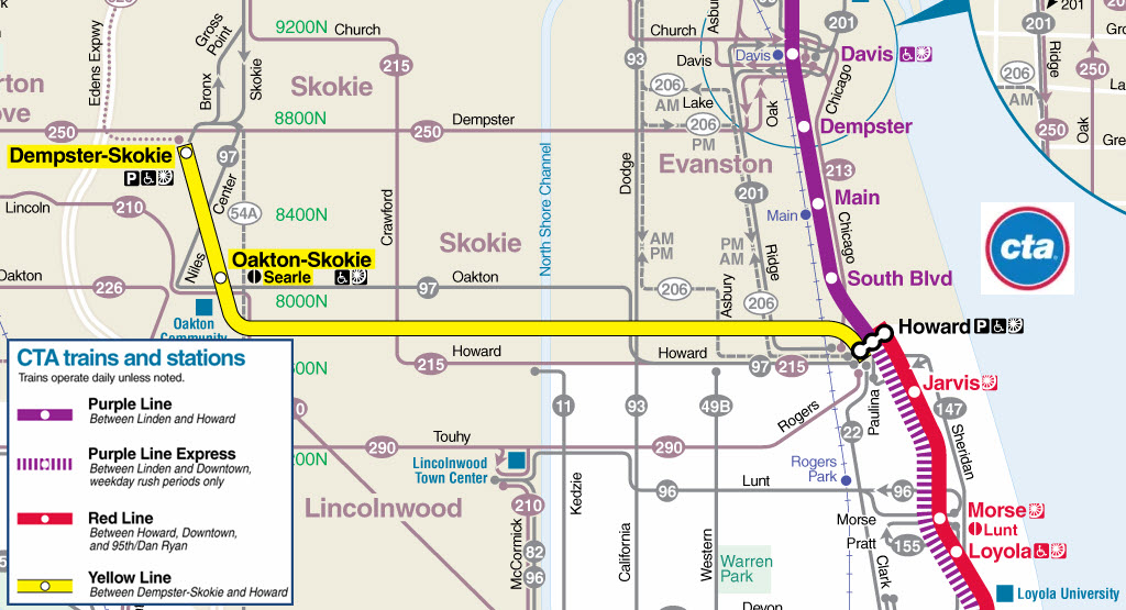
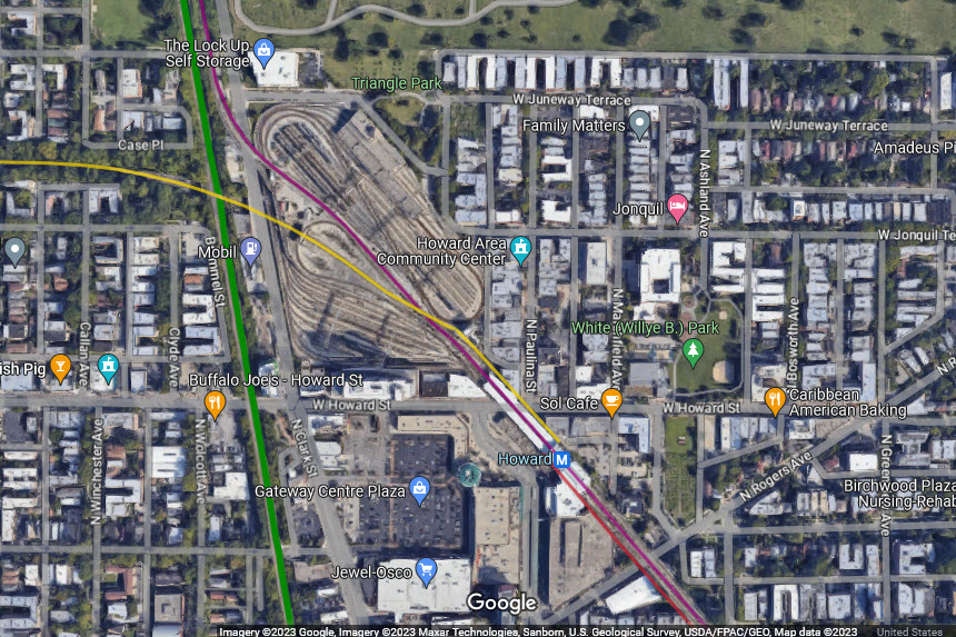
Evanston IL, USA: CTA Howard Station and Howard Yard
GPS Coordinates: 42.01980, -87.67385
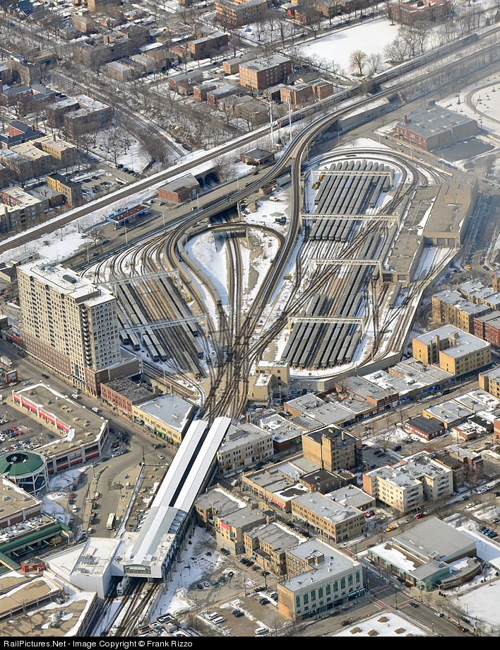
CTA Howard Yard in Evanston IL, 2014.... The Purple Line is going off to the upper right, the Yellow Line to the top left, the Red Line and Howard Station at the bottom, and Metra's UP North Line paralleling the Purple Line. Cool aerial shot, thank you drones!
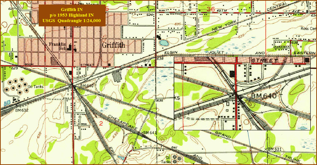
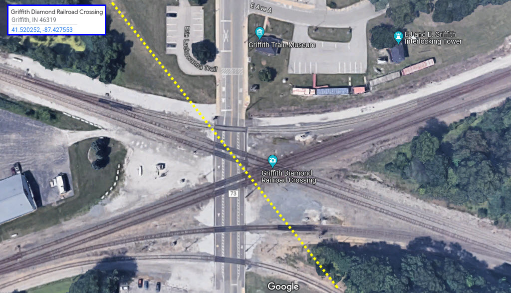
Griffith IN, USA
GPS Coordinates: 41.52024, -87.42759
Triple-Double diamonds in Griffith IN, no longer with us....
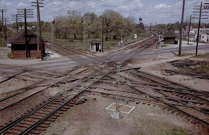
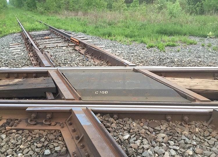
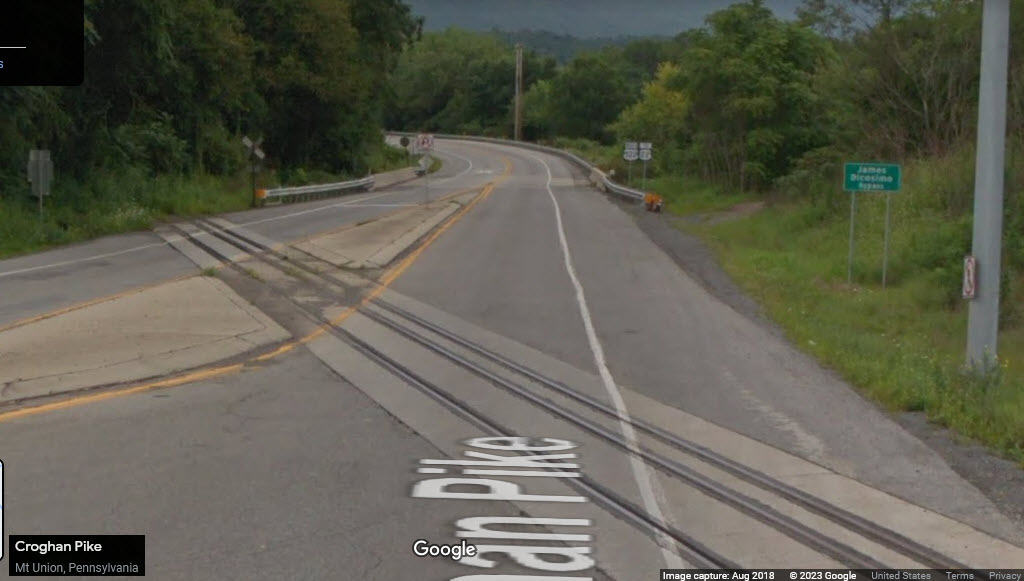
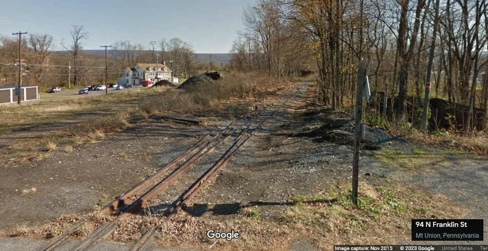
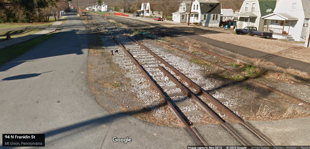
Mt Union PA, USA
This might be the last dual gauge grade crossing made in the United States.... This is where the East Broad Top ran 60+ years ago.
Back "in the city", we have the Franklin Street crossing - looking south we can see the mainline headed to Orbisonia with a couple of switches, looking the other way, we can they have reballasted some of the ROW, and removed the narrow gauge rail.
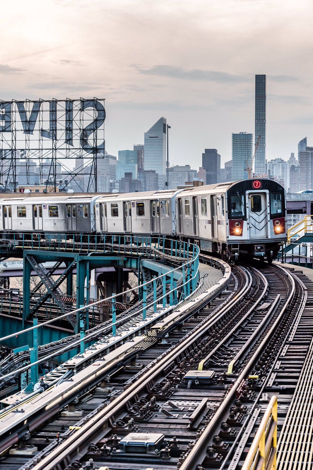
New York, NY, USA: The #7 IRT Line in the Queens
 https://www.pinterest.com/pin/92675704818003874/
 This is included, not so much because of fancy trackwork, but because I used to ride this line all the time as a kid, Queens, New York City
Here we see an outbound "IRT" #7 (the 64/65 World's Fair) Line train coming into the elevated Queensboro Station in the Queens, LIC, NYC
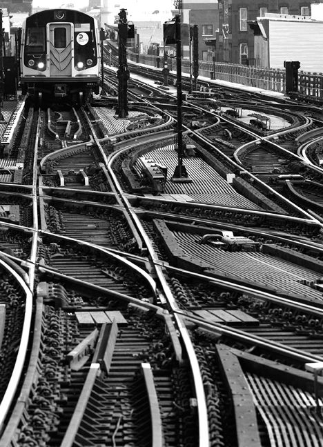
Elsewhere in New York City on the Subway System.....
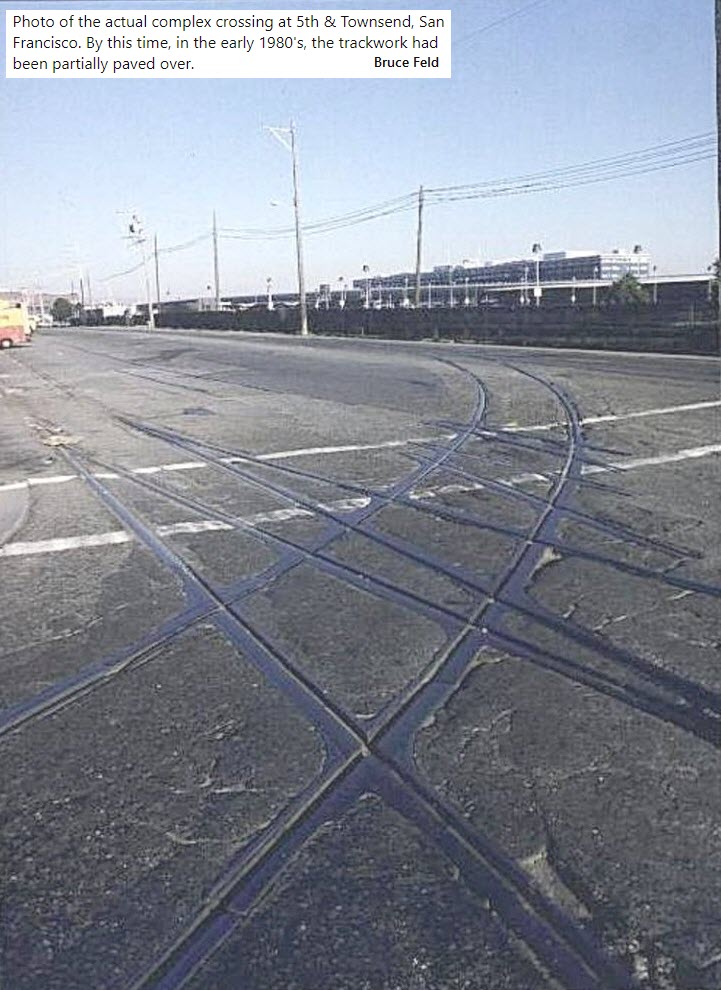
San Francisco CA, USA
Track in downtown San Francisco, early 1980's.
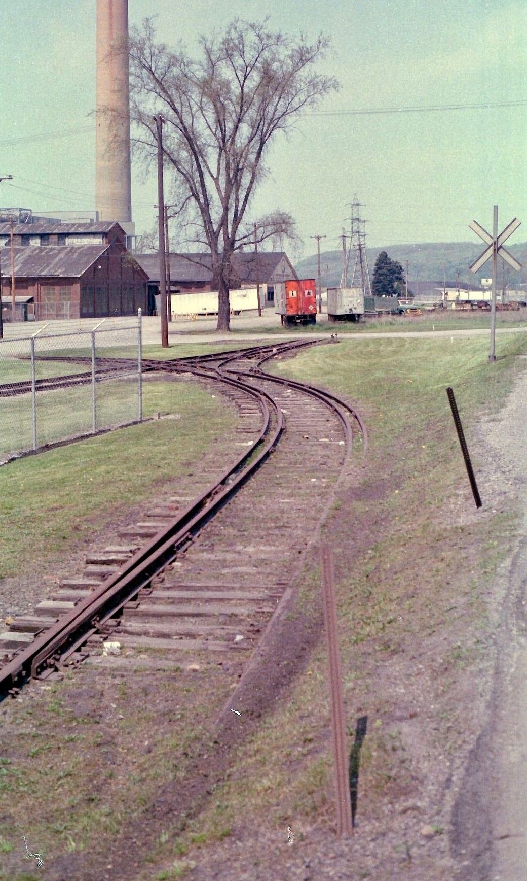
Steubenville OH, USA
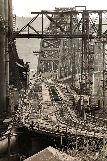
Posted by earthmagnified on flickr, interesting picture of our industrial complex!!!
Jim Mihalek wrote in to me and added: It is looking east down the highline at the Wheeling-Pittsburgh steel plant. The bridge goes over the Ohio River to the coke plant on the other side. The steel mill is gone, shut down around 2006 and torn down. The coke plant was open until about a year ago. They sent coke to the plant at nearby Mingo Junction until that one closed, and then I think they were sending it to Rouge Steel in Detroit.
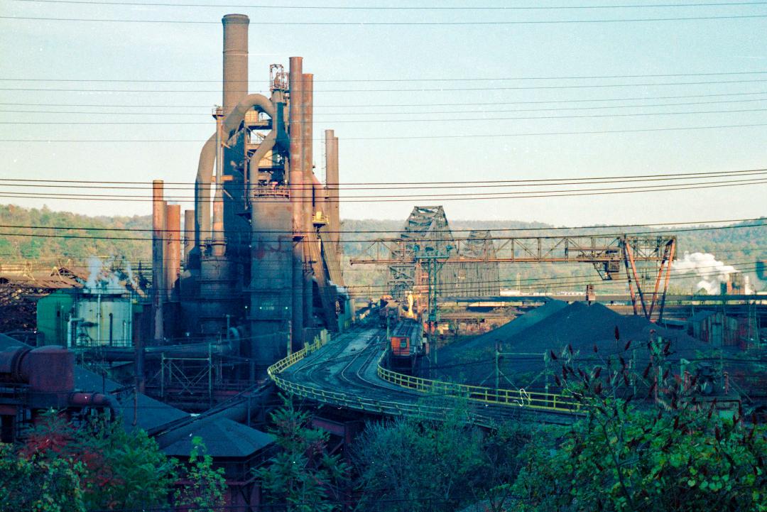
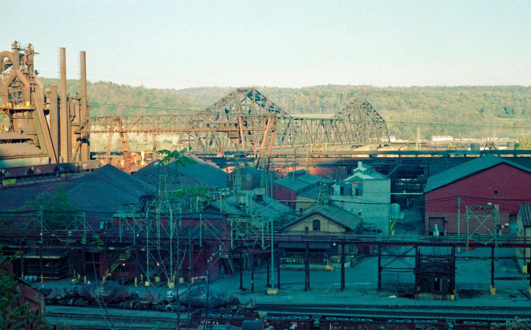
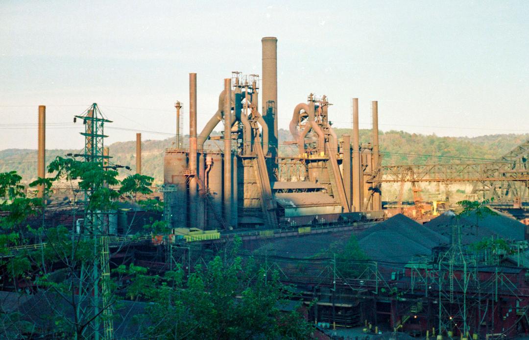
Here are additional pictures taken by Jim:
York PA, USA: Former Ma & Pa RR three-way turnout
GPS Coordinates: 39.96214, -76.71236
This switch was replaced when the current railroad owners reconfigured the yard, but up until 2000 or so, it was a three-way switch to enter the yard, the bypass track, or the scrap-yard siding.
 AUG05/1986, Kevin Mueller, via Flickr
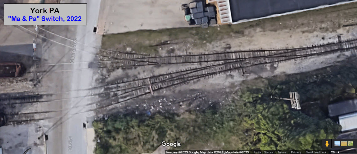
Actually, this whole page is classified as Floobydust :-) LOL
Disclaimers:
New format 10/26/23: Please check out my disclaimer page for my standard dribble and contact info here
RAILFAN GUIDES HOME
RAILROAD SIGNALS HOME
NEW MAY25/2023, MAY26/27/29/2023, JUN23/24/2023, JUL02/06/2023, NOV09/14/2023
Last Modified 14-Nov-2023