
RAILROAD SIGNALS HOME
The Scoop:
I started this page after completing a page for Detroit that covered the majority of bridges and overpasses found in the metro area. This is an introduction to the many varieties of railroad bridges that exist, and some that are no longer with us. For further reading, check out some of the links I have come across.
Bridge - Overpass - Viaduct.... What is the difference? The large majority of the bridges mentioned below can probably be referred to as a bridge or an overpass, and the terms are interchangeable. One fellow who helped me with another page in PA is a "bridge guy", and may disagree. Being that almost all bridges in Detroit are "older", I don't think any qualify as being called a viaduct, but some, like #8 and #9 going to Zug Island, are bridges, and not overpasses or viaducts. I reference this page in Detroit, because, as I said, this is what got me going on this page.
A viaduct is a specific type of bridge that consists of a series of arches, piers or columns supporting a long elevated railway or road. Typically a viaduct connects two points of roughly equal elevation, allowing direct overpass across a wide valley, road, river, or other low-lying terrain features and obstacles.
Acknowledgements:
Structsource
Google Maps
Open Railway Maps
Bing Maps
Denver Todd
Dave Frieder
Scott Dunn
Adam J.W.C
Bob Castle
Rich W.
Websites and other additional information sources of interest for the area:
http://www.structsource.com/railroadbridge/main.html
https://en.wikipedia.org/wiki/Viaduct
http://pghbridges.com/termsBrg.htm
http://pghbridges.com/basics.htm covers railroad and automobile bridges, extensive descriptions, but no pictures or diagrams to help explain
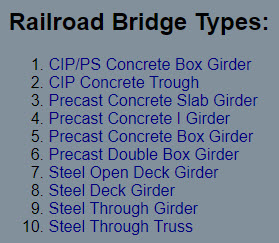
FIXED BRIDGES
Steel Girder
Steel Truss
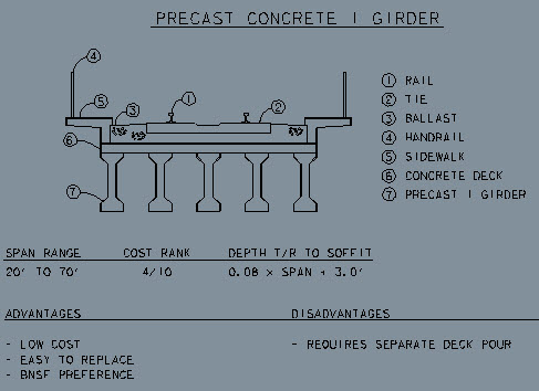
Precast Concrete
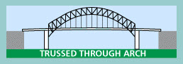
Trussed Through Arch
MOVABLE BRIDGES
ABT Bascule
Lift
Swing
Here is one listing of railroad bridge types, however, it is for "modern" bridges being built today, and doesn't include a lot of the "older" ones found around any town of reasonable "old" age, like Baltimore, Detroit, and Chicago.
 Stuff in grey is from Strucsource
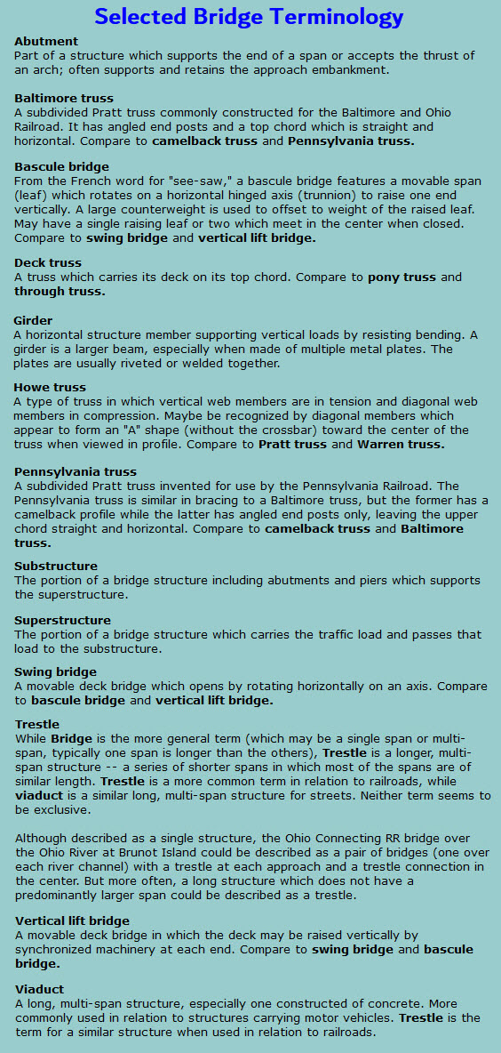 From pghbridges.com
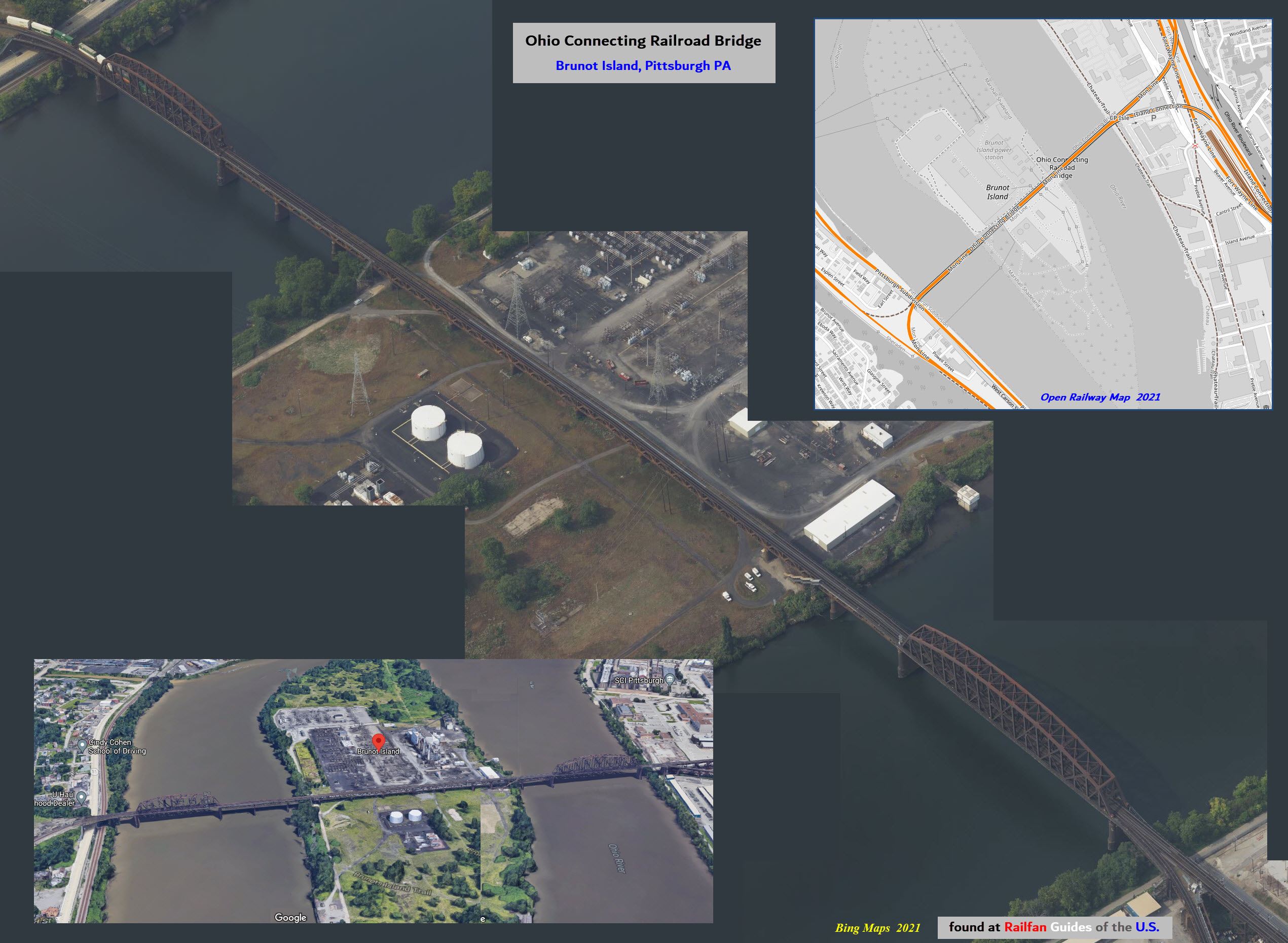
FIXED BRIDGES
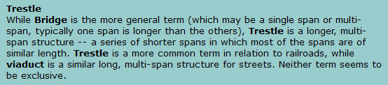
Trestle Type Bridges
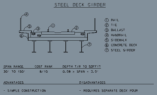
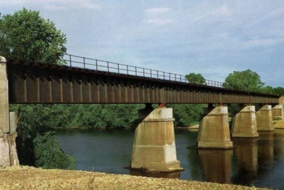
Steel Deck Girder
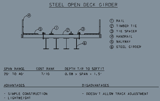
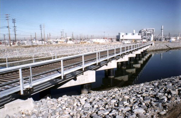
Steel Open Deck Girder
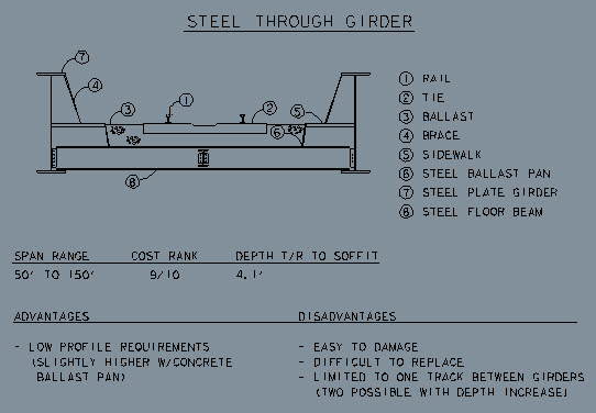
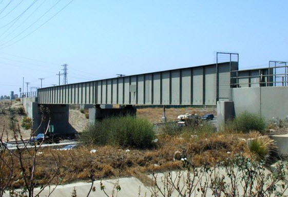
Steel Through Girder
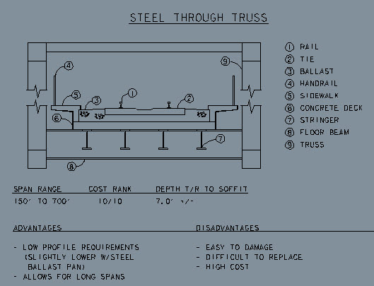
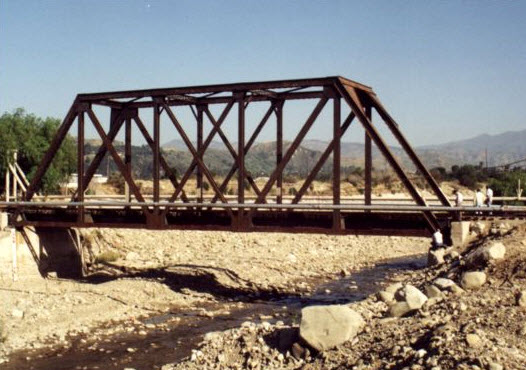
Steel Through Truss
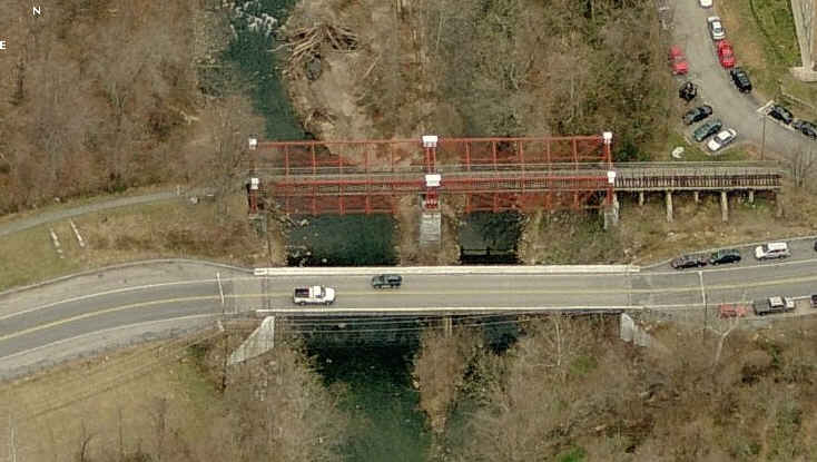
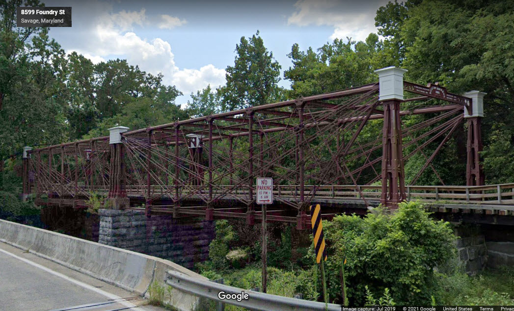
Bollman Iron Truss
GPS Coordinates: 39.13485, -76.82506
This is the only surviving example of this type of bridge, built by the B&O in 1852, and moved to Savage MD in 1887.
I have a whole page dedicated to this bridge here.
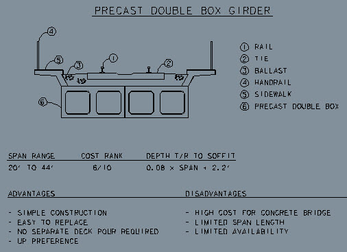
Precast Concrete Double Box Girder
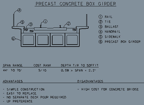
Precast Concrete Box Girder
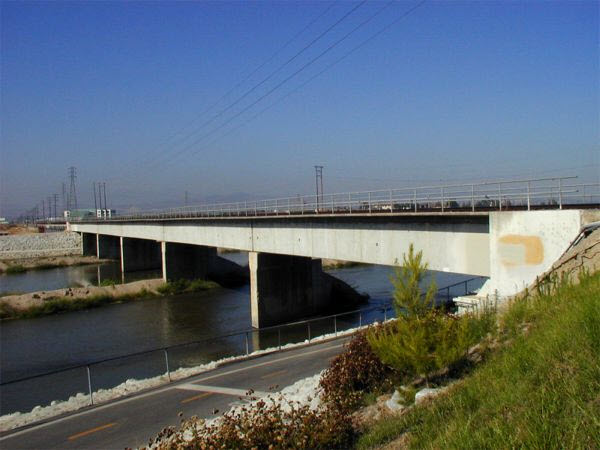
Precast Concrete I-Beam Girder
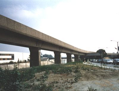
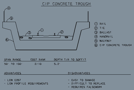
CIP Concrete Trough
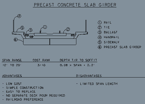
Precast Concrete Slab Girder
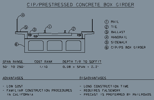
Prestressed Concrete Box Girder
Hell Gate Bridge
GPS Coordinates: 40.78269, -73.92219
https://railfanguides.us/ny/NYChellgate/index.htm
https://en.wikipedia.org/wiki/Hell_Gate_Bridge
https://en.wikipedia.org/wiki/Sydney_Harbour_Bridge
https://en.wikipedia.org/wiki/Tyne_Bridge
A bridge (almost) in a class all of it's own. I used to sit up at night in the 60's and watch the New Haven trains come and go over this bridge. Priceless memories!!!
Hell Gate is not the largest, but it was the first, completed in 1916. It is 1,017 feet long, but 17,000 feet if you include the elevated approaches, and clears the water below by 135 feet. It goes between the Queens and the Bronx via Ward and Randall Islands. It was built by the New Haven RR.
Sydney Australia has the largest of these: the Sydney Harbour Bridge - it carries car, rail, and pedestrian traffic, and you can even climb to the top of it! It was completed in 1932, and Hell Gate did provide the inspiration for using this type. It is 1,149ft long, and sits 161 feet above the water. It carries 8 car lanes and 2 streetcar tracks electrified at 1,500 volts.
A third example of this type of bridge is the Tyne Bridge in Newcastle, England. It is 1,276ft long, and opened in 1928.
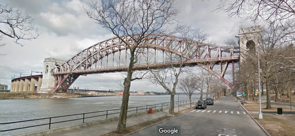
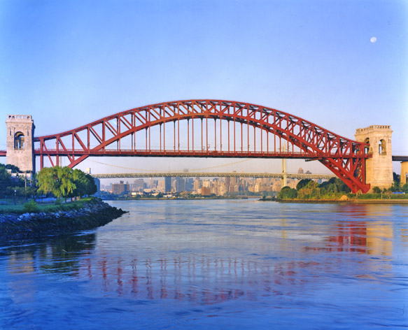 photo by Dave Frieder via Wikipedia
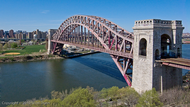 photo by Scott Dunn
The Sydney Harbour Bridge, photo by Adam J.W.C, 2008, via Wikipedia
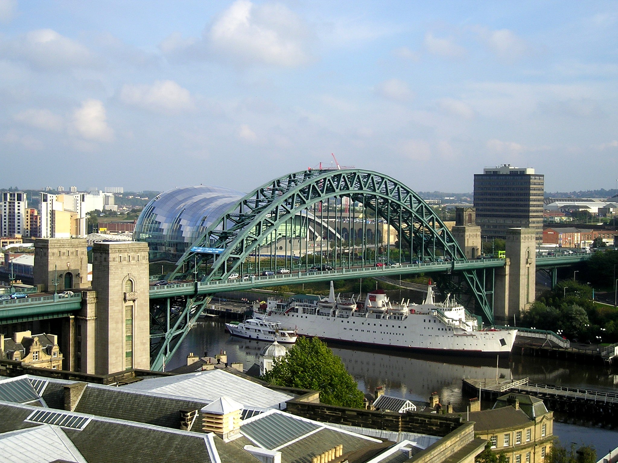
The Tyne Bridge, photo by Bob Castle, 2006, via Wikipedia
MOVABLE BRIDGES
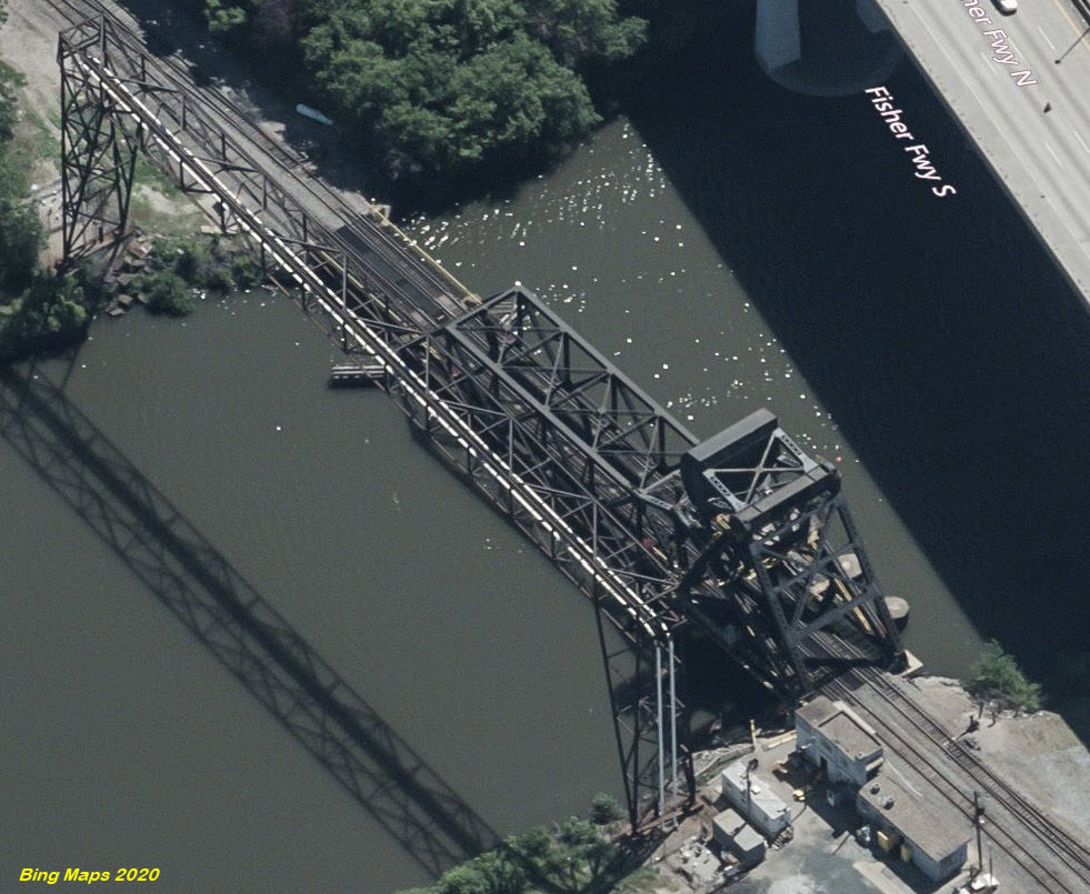
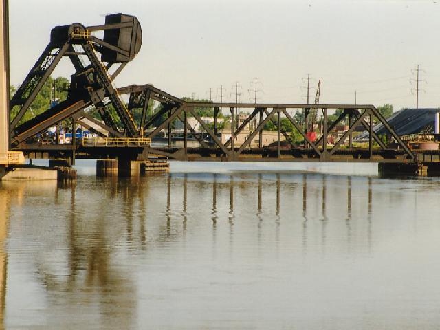
GPS Coordinates: 42.17247, -83.08392
https://historicbridges.org/bridges/browser/?bridgebrowser=michigan/rougens/
http://www.michiganrailroads.com/stations-locations/498-wayne-county-82/wayne-co-a-c/2174-bridge-rouge-detroit-mi-wabash-ns
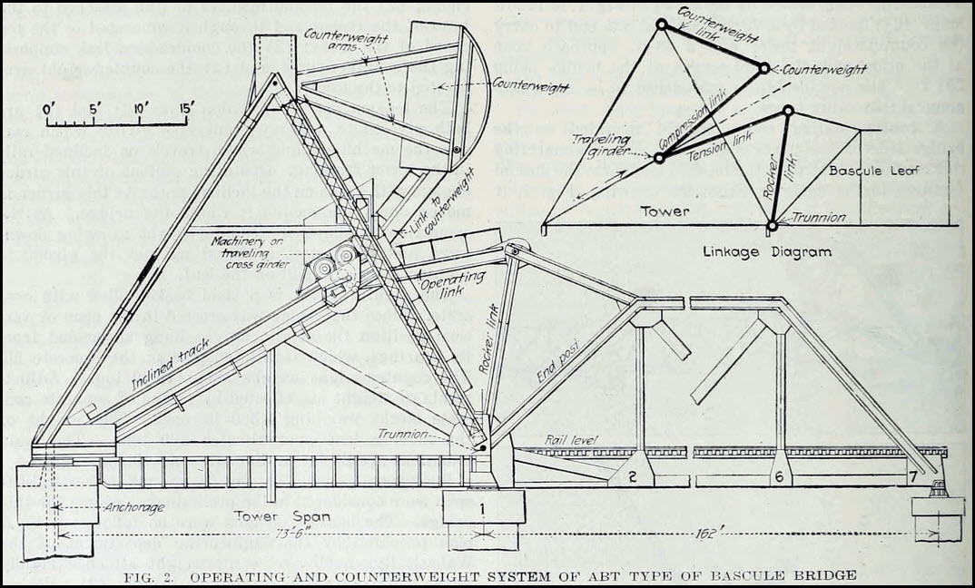
This bridge was built by the Wabash in the mid 1920's, and replaced a swing bridge when the Rouge River was widened for the Ford plant. It was also used by the Detroit & Toledo Shore Line Railroad, and later the Pennsy later in the 1920's. It is a bascule bridge that utilizes a complex counterweight that moves to adjust the weight as the bridge raises and lowers, a patented design called the ABT Bascule bridge. It is among the rarest bascule bridge types in the country. Michigan has three examples. Just about the only way to get good pictures is by boat!
Dock Bridge, Newark NJ
This "bridge" is actually two parallel spans crossing the Passaic River, and they carry Amtrak and NJT trains running on the North East Corridor.
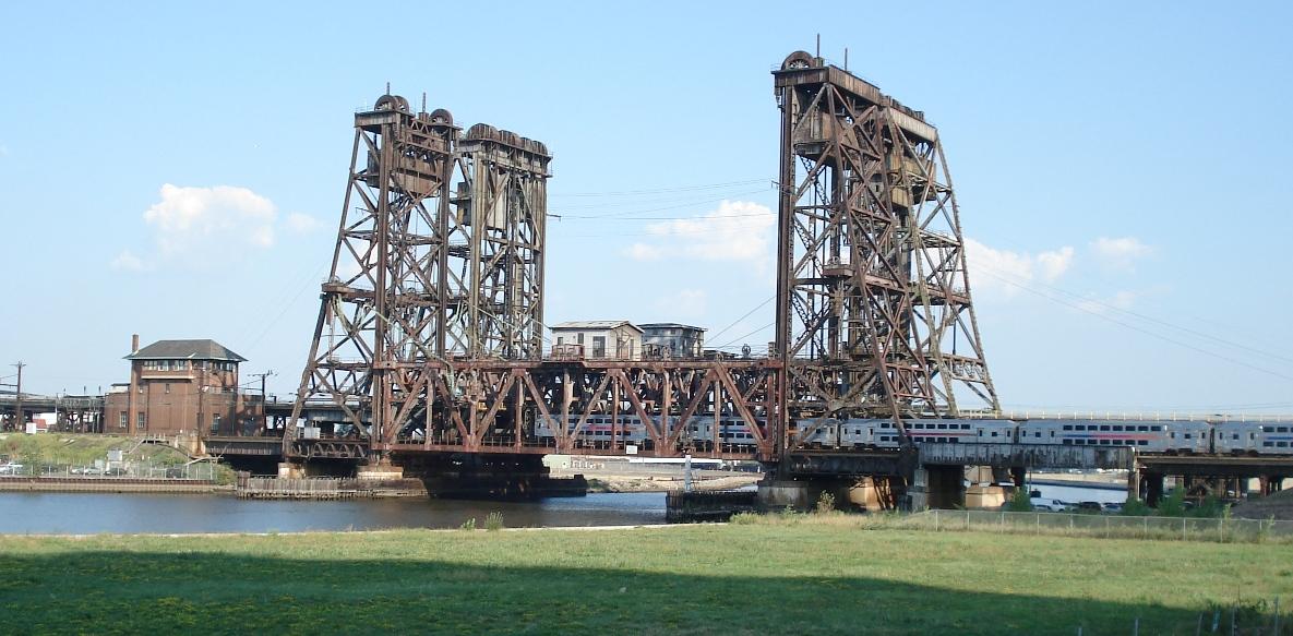 photo by Rich W.
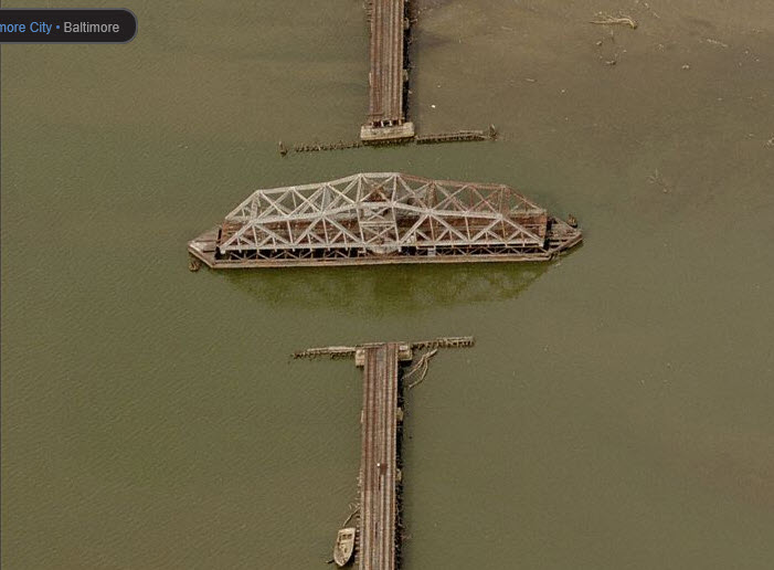
Spring Garden Swing Bridge, Baltimore MD
This bridge was built by the Western Maryland Rwy to connect the east and west sides of an inlet, so the WM trains could get to Port Covington Yard. Once the WM disappeared and they tore up the yard, the bridge was no longer needed, so they left it in it's open position. Since that aerial picture from Bing was taken, the tracks have been removed.
Disclaimers:
I love trains, and I love signals. I am not an expert. My webpages reflect what I find on the topic of the page. This is something I have fun with while trying to help others.
Please Note: Since the main focus of my two websites is railroad signals, the railfan guides are oriented towards the signal fan being able to locate them. For those of you into the modeling aspect of our hobby, my indexa page has a list of almost everything railroad oriented I can think of to provide you with at least a few pictures to help you detail your pike.
If this is a railfan page, every effort has been made to make sure that the information contained on this map and in this railfan guide is correct. Once in a while, an error may creep in :-)
My philosophy: Pictures and maps are worth a thousand words, especially for railfanning. Text descriptions only get you so far, especially if you get lost or disoriented. Take along good maps.... a GPS is OK to get somewhere, but maps are still better if you get lost! I belong to AAA, which allows you to get local maps for free when you visit the local branches. ADC puts out a nice series of county maps for the Washington DC area, but their state maps do not have the railroads on them. If you can find em, I like the National Geographic map book of the U.S..... good, clear, and concise graphics, and they do a really good job of showing you where tourist type attractions are, although they too lack the railroads. Other notes about specific areas will show up on that page if known.
Aerial shots were taken from either Google or Bing Maps as noted. Screen captures are made with Snagit, a Techsmith product... a great tool if you have never used it!
By the way, floobydust is a term I picked up 30-40 years ago from a National Semiconductor data book, and means miscellaneous and/or other stuff.
Pictures and additional information is always needed if anyone feels inclined to take 'em, send 'em, and share 'em, or if you have something to add or correct.... credit is always given! Please be NICE!!! Contact info is here
Beware: If used as a source, ANYTHING from Wikipedia must be treated as being possibly being inaccurate, wrong, or not true.
RAILFAN GUIDES HOME
RAILROAD SIGNALS HOME
NEW AUG29/2021
Last Modified 01-Sep-2021