

In General
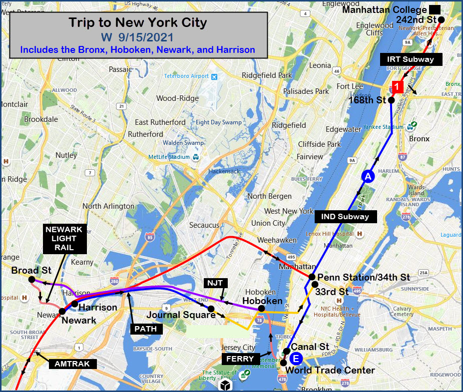
Map
Sights
Pictures
Floobydust
RAILFAN GUIDES HOME
RAILROAD SIGNALS HOME
Location / Name:
New York City NY
What's Here:
Subways, Subways, Subways
NJT and Metro North Regional Commuter Rail
Path (Heavy Rail/Subway)
Newark Subway/Light Rail
Amtrak
Data:
GPS Coordinates: as needed
Phone A/C: 212/Manhattan, 718/Bronx, 201/Hoboken NJ, 973/Newark NJ
ZIP: n/a
Access by train/transit:
Listed Above....
The Scoop:
My buddy John called up a few weeks ago and asked me if I wanted to go to New York City (again) via Amtrak, because they were offering a $29 one-way ticket between Baltimore/DC and New York. Why would I turn that down? :-)
Acknowledgements:
Brother Augie Nicoletti
Websites and other additional information sources of interest for the area:
https://en.wikipedia.org/wiki/PATH_(rail_system)
https://www.amtrak.com/stations/nyp
| Amtrak | Lv Penn Station/Baltimore | 07:04 | Train #130 / car 71033 |
| Aberdeen MD | 07:29-07:31 | ||
| Wilmington DE | 07:59-08:01 | ||
| Philadelphia PA | 08:28-08:30 | ||
| Trenton NJ | 09:00-09:03 | ||
| Metro Park NJ | 09:28-09:30 | ||
| Newark NJ | 09:48-09:50 | ||
| Ar Penn Station NYC | 10:07 | ||
| NYC Subway / IND A Train | 34th St to 168th St | 10:38-10:53 | 8th Ave Express |
| NYC Subway / IRT #1 Train | 168th St to 242nd St | 11:07-11:24 | Car #2329 |
| At Manhattan College | 11:32-13:25 | Beautiful Campus!!! | |
| NYC Subway / IRT #1 Train | 242nd St to 168th St | 13:47-13:59 | |
| NYC Subway / IND A Train | 168th St to Canal St | 14:06-14:35 | Car #6234 |
| NYC Subway / IND E Train | Canal St to the WTC | 14:36-14:37 | Car #9204 |
| Ferry | 12th St to Hoboken E-L Terminal | 15:11-15:19 | |
| NJT Commuter / Morristown Line | Hoboken Terminal to Newark Broad St | 15:29-15:50 | Train #485 / Car 1483 |
| NJT Newark Light Rail | Broad St to Penn Station | 15:56-16:06 | |
| PATH | Penn Station to Harrison | 16:22- | Car #5801 |
| PATH | Harrison to Journal Square | 17:01-17:08 | |
| PATH | Journal Square to 33rd St/NYC | 17:17-17:38 | Car #5719 |
| at Tir Na Nog for dinner | 17:55-19:18 | Great Food! Great Atmosphere! |
| Amtrak | Lv Penn Station NYC | 19:40 | |
| Newark NJ | 19:57-19:59 | ||
| Newark Airport | 20:03-20:05 | ||
| Metro Park NJ | 20:15-20:17 | ||
| Trenton NJ | 20:39-20:40 | ||
| Philadelphia PA | 21:13-21:16 | ||
| Wilmington DE | 21:37-21:39 | ||
| Ar Baltimore MD | 22:27-22:50 | Train in station for 10 minutes!??? / Car #71033 / Engine #656 / Engineer: Will |
Penn Station / Baltimore
The
Pictures Enroute
The
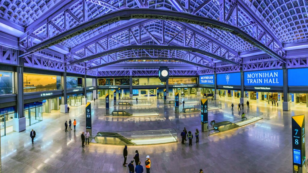
Penn Station NYC
The
On the A Train
The
168th Street / IRT Station
The
242nd Street
The
Manhattan College
The
IND E Train / Canal Street Station
The
World Trade Center
The
The Ferry
The
Hoboken Terminal
The
Newark Broad Street
The
Newark Light Rail
The
Newark Penn Station
The
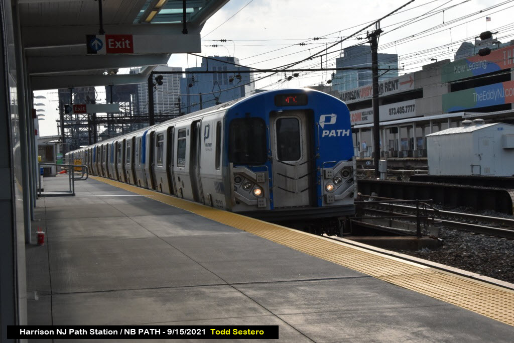
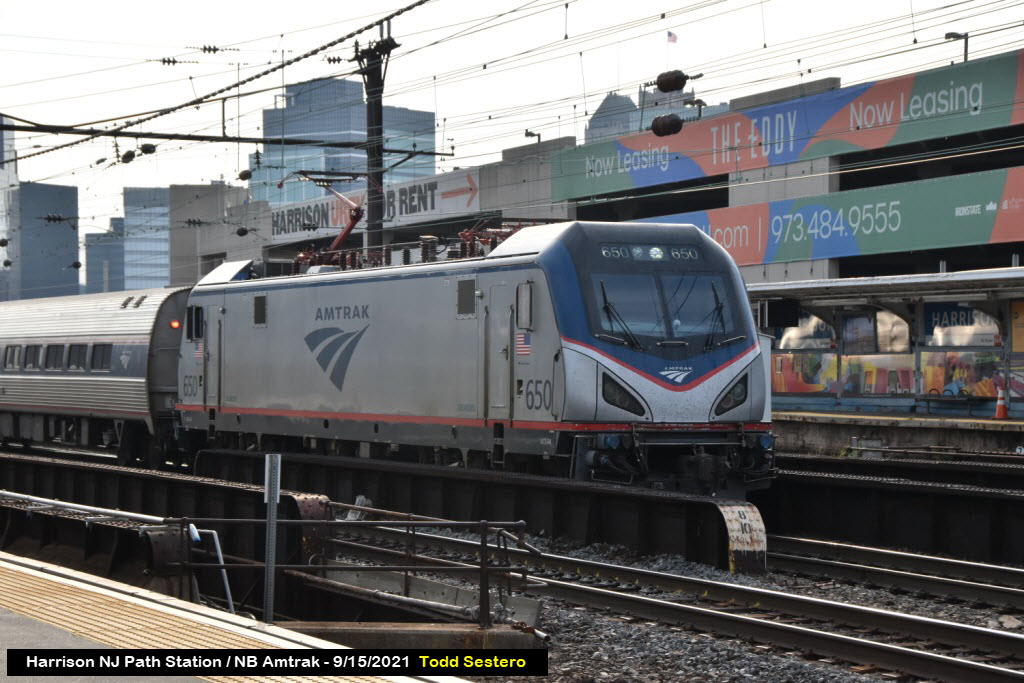
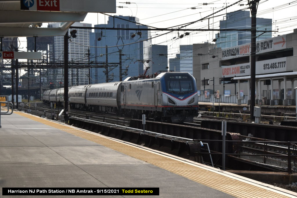
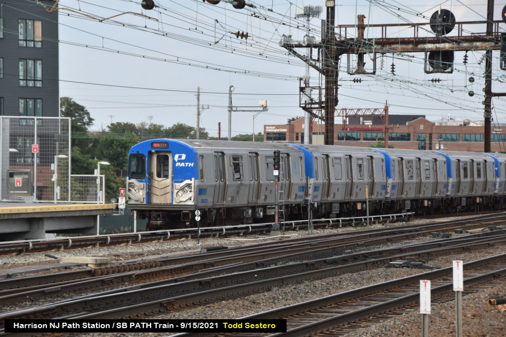
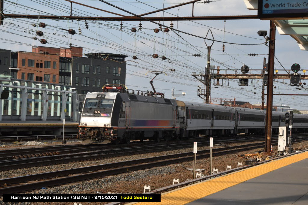
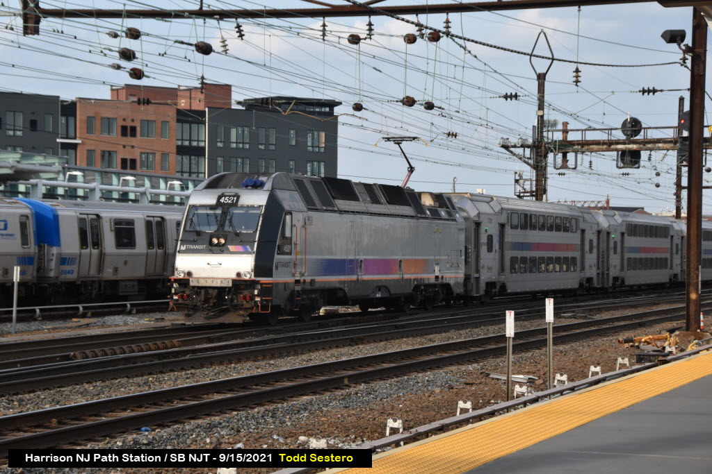
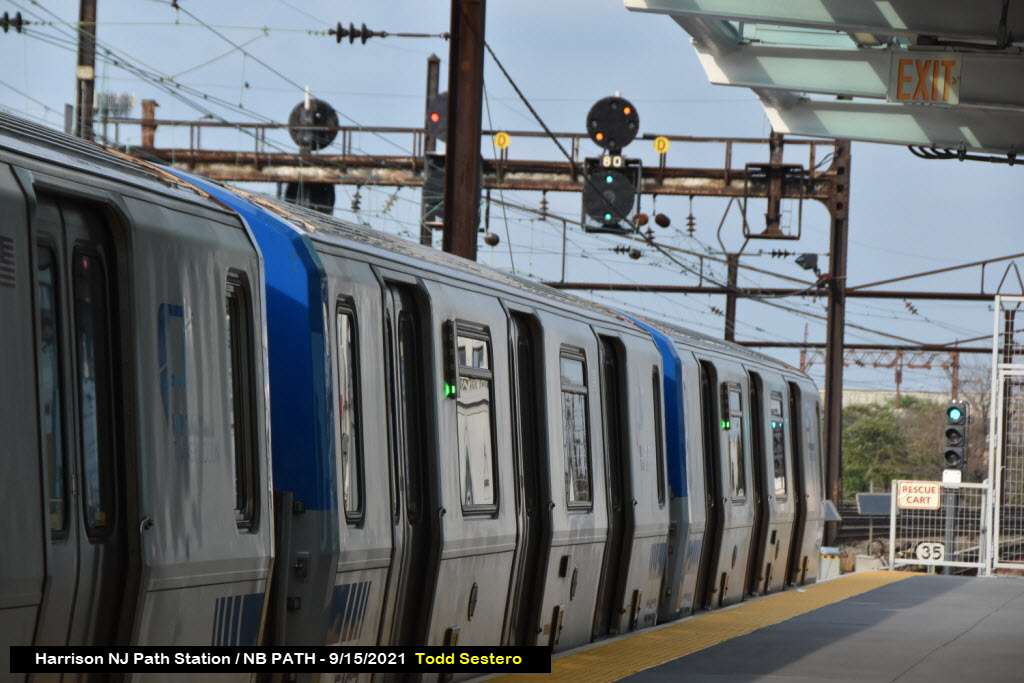
at Harrison PATH Station
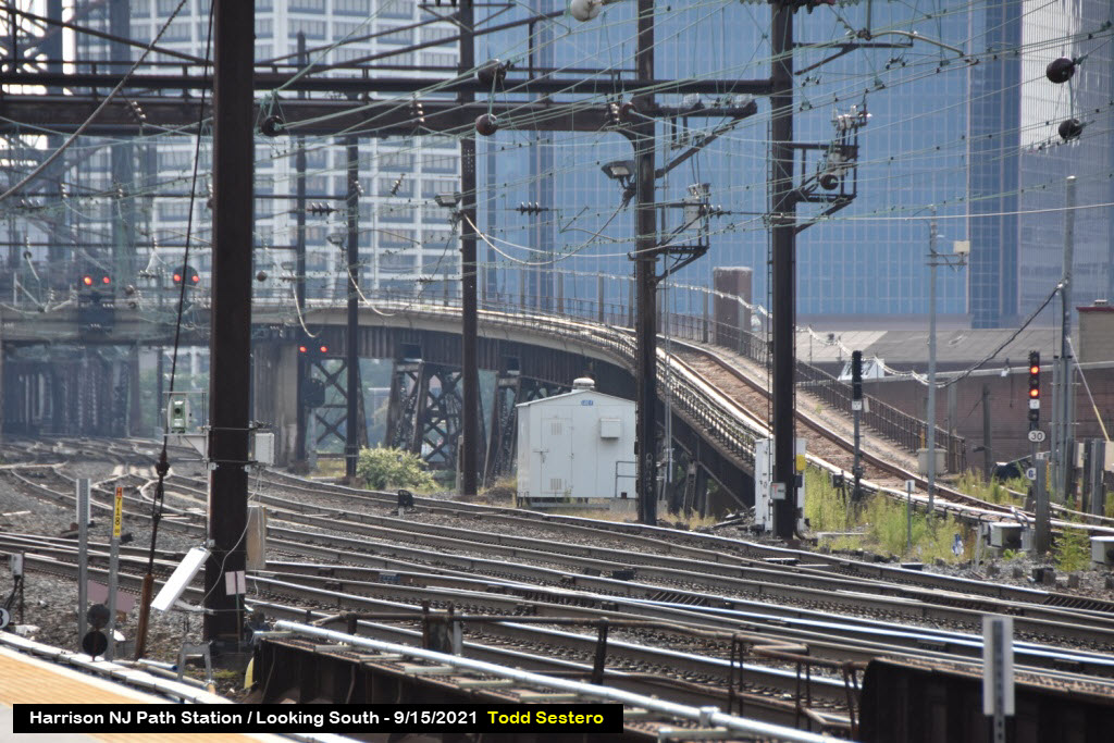
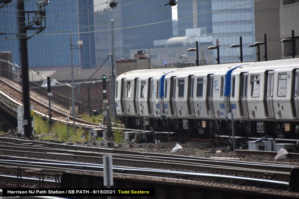
Harrison is one of the busiest places to be during the rush hour. You have an Amtrak, New Jersey Transit, or PATH train coming by almost every minute. The only thing missing is freight :-)... But if you're into electric powered trains, this is one of the best places to be! Some of the NJT trains are diesel powered since they leave the NEC.
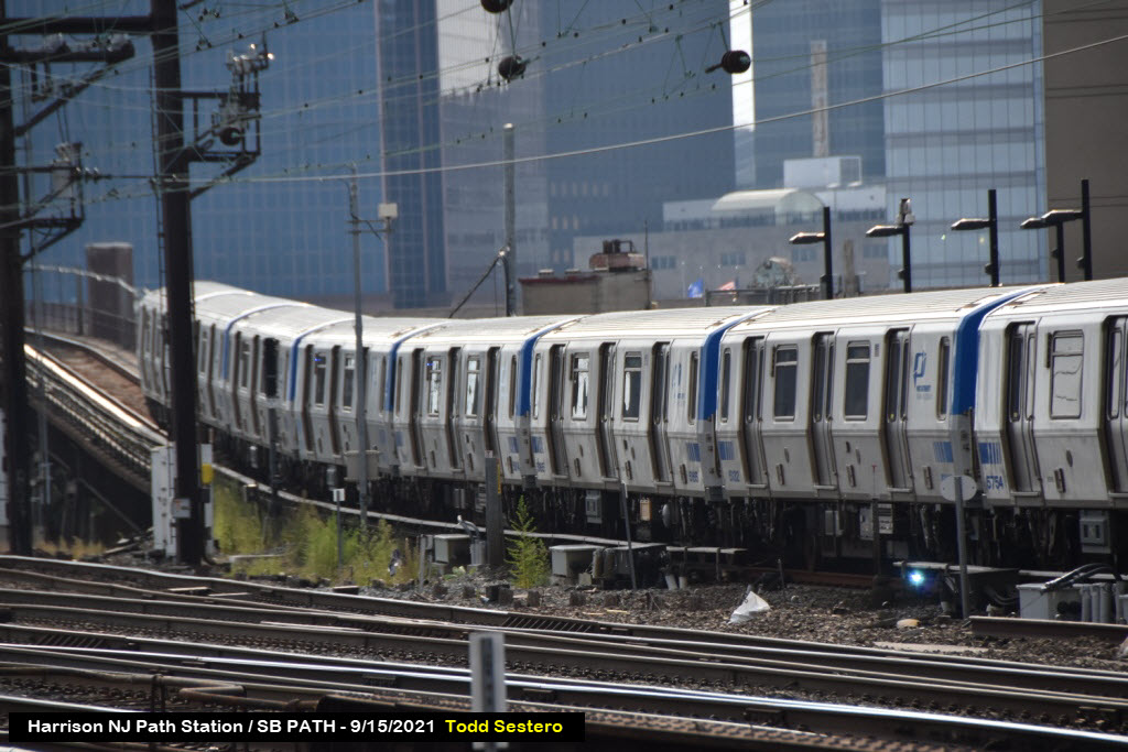
Do you know how many pictures I had to take in order to catch that arcing? :-)
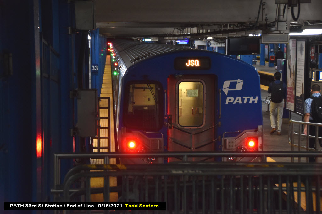
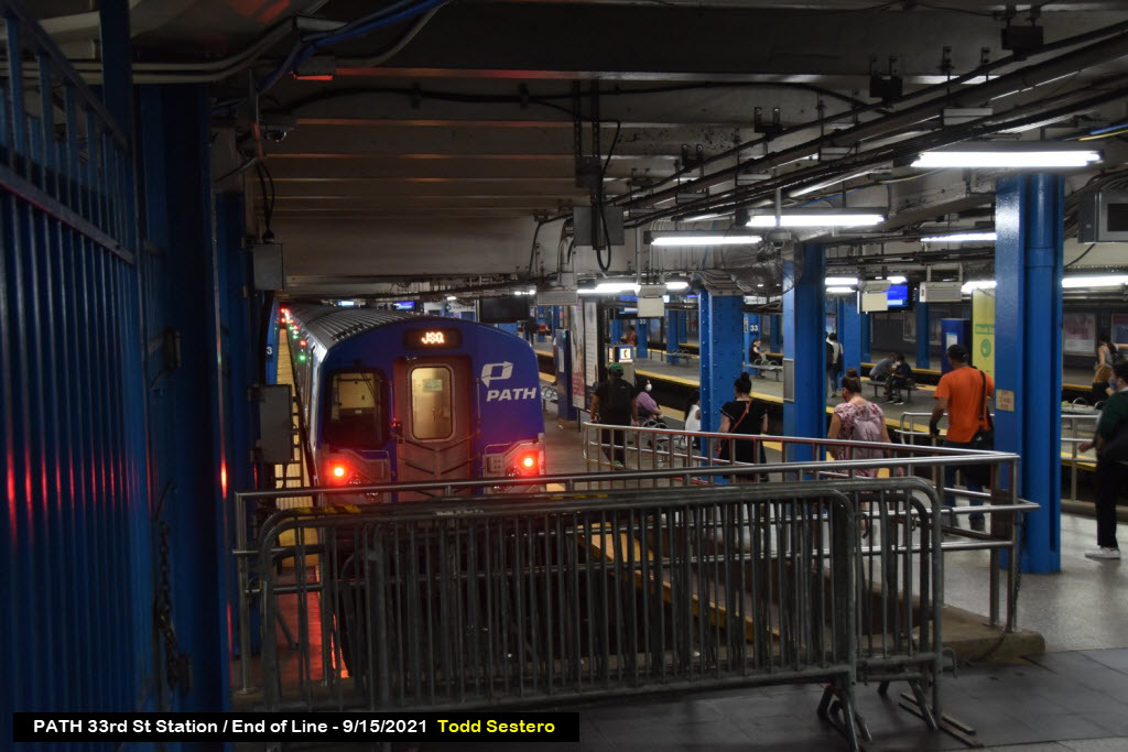
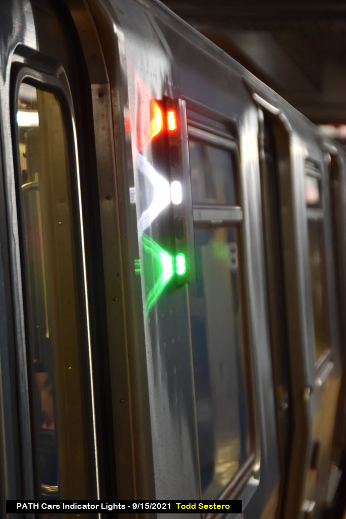
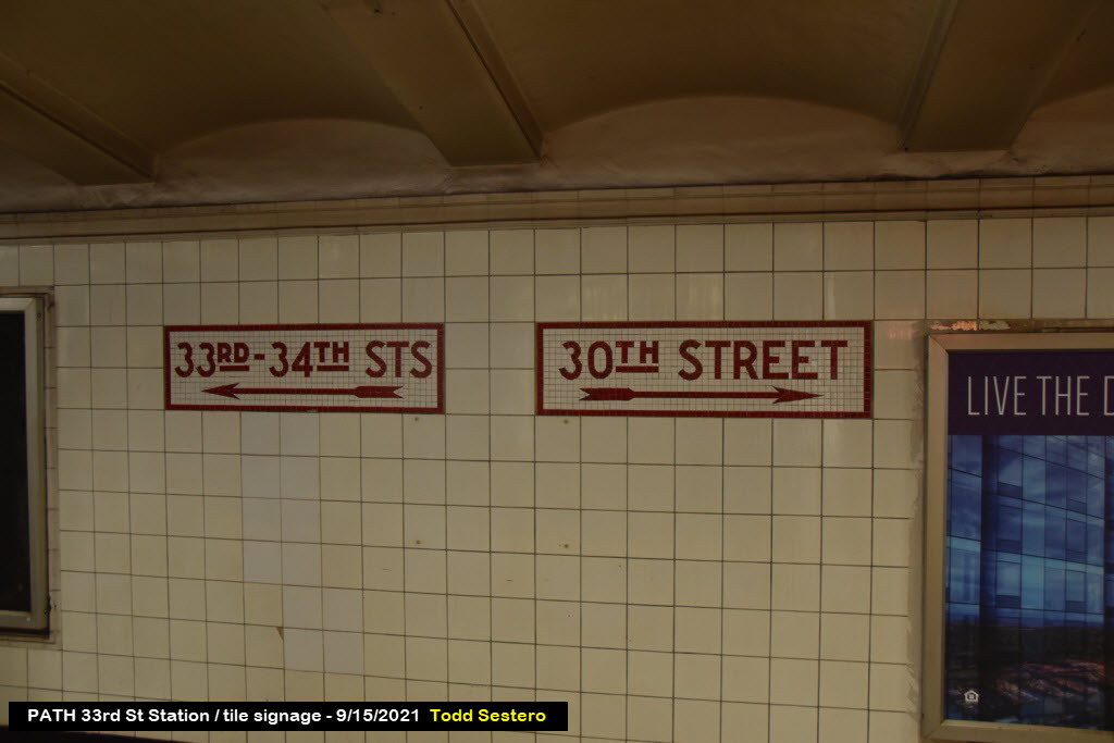
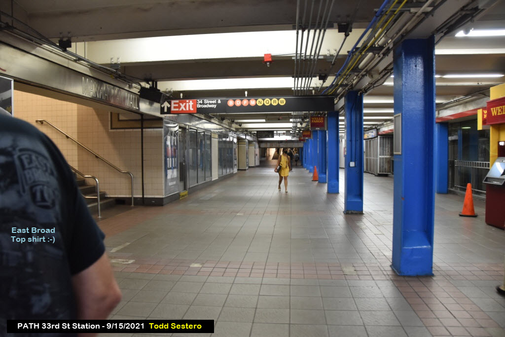
PATH 33rd St Station
This is the last station in New York City for the BLUE and YELLOW lines... Unbelievable how busy this station is during rush hour!!!


Meanwhile, back at Penn Station / NYC
The
Penn Station / Baltimore
The
11
The
22
The
33
The
44
The
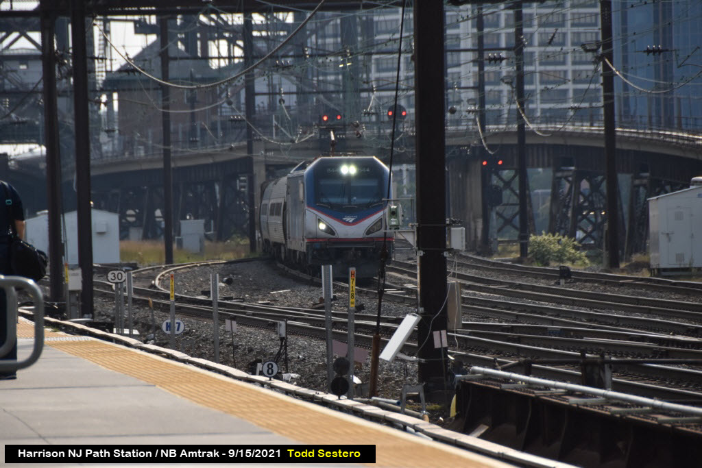
At the Harrison NJ PATH Station
It looks like you might have a slightly better watching experience for NB trains from the NB platform, due to the slight curvature of the line on both sides of the station. For SB trains, the SB platform looks like it might have the advantage for approaching trains coming out of New York (didn't get over there to test out this theory :-)
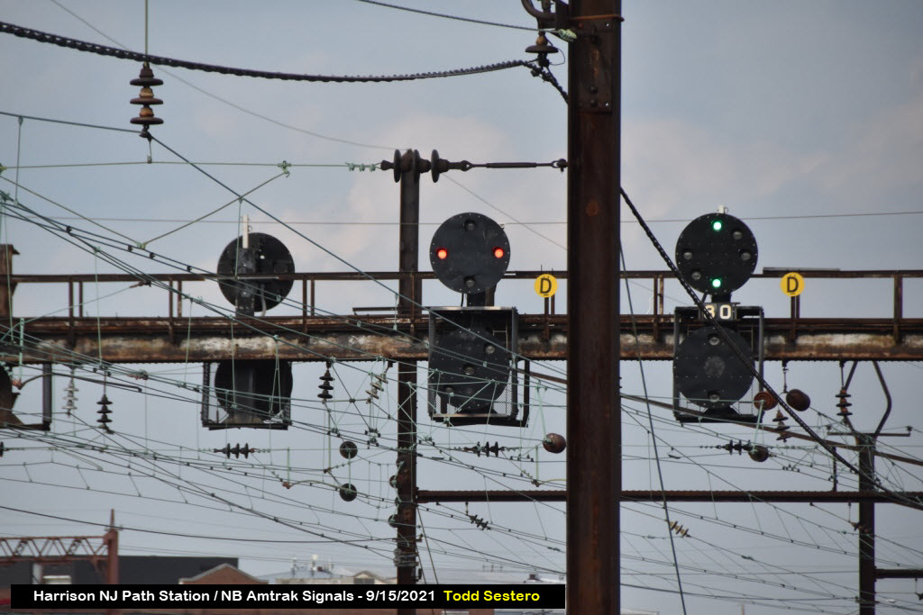
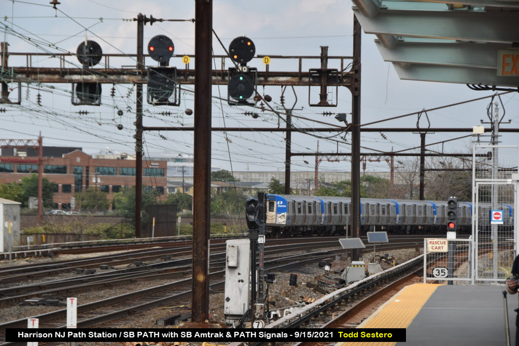
The first picture is looking south. We have three Amtrak PCL signals and a standard dual head transit colorlight signal for PATH. If you look close, there is a PL dwarf just to the left of the center of the picture - it's not very evident on this lower res picture.
55
The
About PATH
From Wikipedia: Port Authority Trans-Hudson (PATH) is a 13.8-mile (22.2 km) rapid transit system in the northeastern New Jersey cities of Newark, Harrison, Jersey City, and Hoboken, as well as Lower and Midtown Manhattan in New York City. It is operated as a wholly owned subsidiary of the Port Authority of New York and New Jersey. PATH trains run around the clock year round; four routes serving 13 stations operate during the daytime on weekdays, while two routes operate during weekends, late nights, and holidays. Its tracks cross the Hudson River through century-old cast iron tubes that rest on the river bottom under a thin layer of silt. It operates as a deep-level subway in Manhattan and the Jersey City/Hoboken riverfront; from Grove Street in Jersey City to Newark, trains run in open cuts, at grade level, and on elevated track.
The routes of the PATH system were originally operated by the Hudson & Manhattan Railroad (H&M), built to link New Jersey's Hudson Waterfront with New York City. The system began operations in 1908 and was fully built out in 1911. Three stations have since closed; two others were re-located after a re-alignment of the western terminus. From the 1920s, the rise of automobile travel and the concurrent construction of bridges and tunnels across the river sent the H&M into a financial decline from which it never recovered, and it was forced into bankruptcy in 1954. As part of the deal that cleared the way for the construction of the original World Trade Center, the Port Authority bought the H&M out of receivership in 1962 and renamed it PATH. In the 2000s and 2010s the system suffered considerably from disasters that affected the region, most notably the September 11 attacks and Hurricane Sandy. Both private and public stakeholders have proposed expanding PATH service in New Jersey, and an extension to Newark Liberty International Airport may be constructed in the 2020s.
Although PATH has long operated as a rapid transit system, it is legally a commuter railroad under the jurisdiction of the Federal Railroad Administration (FRA); its trackage between Newark and Jersey City is located in close proximity to Northeast Corridor trackage and shares the Newark Dock Bridge with intercity and commuter trains. All PATH train operators must therefore be licensed railroad engineers and extra inspections are required. PATH currently uses one class of rolling stock, the PA5, which was delivered in 2009–2011.
Disclaimers:
New format 10/26/23: Please check out my disclaimer page for my standard dribble and contact info here
RAILFAN GUIDES HOME
RAILROAD SIGNALS HOME
NEW 9/16/2021, SEP05/2025
Last Modified
05-Sep-2025