Sleepers, or stringers, are early railroad "ties" made from rock
- usually granite, marble, or whatever could be found locally. They seem to be entirely an eastern phenomenon, mostly since the
railroads being built in the very early days of railroading in the U.S.
(1832-1835 or so) were experimenting with different approaches to track
laying techniques - prior to the common use of wooden ties. Sleeper is
also a term that can be used for the familiar wooden railroad tie, but not
so much any more.
It didn't take long for the railroads to figure out that installing
stone sleepers was about ten times more costly than laying down wood ties,
but that couldn't be done until a way to preserve the wood came along,
which, according to the Old Main Line page, wasn't until 1836 when
creosoting was patented. In
addition, there was nothing to keep the stones from moving, which meant the
track could easily go out of gauge.
I know of five railroads (so far) that used sleepers:
-- the Baltimore and Susquehanna Railway
-- the Philadelphia & Columbia Railroad
-- the Allegheny Portage Railroad
-- the Camden and Amboy Railroad
-- the Baltimore and Ohio Railroad
Probably the first use of sleepers was by the Baltimore and Ohio, on their original
mainline from Baltimore to Ellicott Mills MD. Several are on display at
the B&O Railroad Museum in downtown Baltimore.
Acknowledgements:
Steve Okonski
Dave Hiteshew
morgan-nj.org
Google Maps
Wikipedia
The original mainline for the Baltimore and Susquehanna (later the Northern
Central and then the Pennsy) used them (at least) in the Timonium MD
area. They were installed in the 1833 time frame, as they were
trying to go north out of Baltimore towards York and Harrisburg PA.
These sleepers were made from marble that
came from a local quarry, located in Texas MD, a small community located between
Timonium and Cockeysville MD. FIY - Marble from this quarry was also used
to construct the Washington Monument in
Washington DC, and when the monument was refurbished in the late 1990's, they
came back to the quarry to get more marble so it would match.
The sleepers were uncovered en mass during
the construction of the Light Rail system in the 89-90 timeframe, and again in
2005 when the northern end was double-tracked. Several hundred of them
could be seen adjacent to the single track as it approached Padonia Road from
the south. Several dozen more were uncovered at Industry Lane, less than a
mile north of the Padonia Rd location. How far north they go, I guess we
will never know. Yours truly made a valiant
effort to have some removed and saved so they could be put on display somewhere,
but met stiff resistance from both the Mass Transit Administration, and the
State Historical Society. One particularly ignorant thing the fellow at
the MTA said, was "how do you know how to remove the stones without damaging
them" (he was ridiculing my lack of expertise as an archeologist, and not
knowing the proper methods for uncovering artifacts), and no more than two weeks
later, the bulldozers clearing the R-O-W at Industry Lane came along and scraped
the top of almost all of the sleepers. So much for the state being a
competent guardian of the stones. One of the other arguments I was given
was "why should we pull them out of the ground now, when in the future, they may
develop better methods of obtaining information on their history".
I've rarely heard so much government BS (to my face) in my life! Needless
to say, they are now ALL covered up by the northbound track for the foreseeable
future. A few were still around to be saved in the 1995-98 timeframe.
The B&S sleepers were not consistently cut in size or shape. They are
rough cut, except for the "rail groove". The sleepers
are grooved with a slot to lay the rail in, and I suspect the rail was laid
directly on the marble, and secured with either two or four bolts. Judging
from the fact that the grooves in the top of the sleepers are not the same
depth, the sleepers were probably put in the ground, and then the groove would
be cut to make the track lay as level as possible.
One shot of the stones at Industry Lane, during the light rail double-tracking in 2005.
In June of 2026, I happened to stop by the Historic Society of Baltimore County,
and noticed they have two of the B&S sleepers sitting outside
the old Alms House that serves as their headquarters.
If you plan to visit the HSBC, they have a really small window of opportunity to do so,
being open only on Fridays and Saturdays between 10am and 2pm.
See below for more info on the HSBC.
The Philadelphia & Columbia Railroad was part of the railroad-canal system trying
to compete with the Erie canal. Several hundred sleepers were
uncovered east of Columbia PA, adjacent to the Pennsy mainline between
Philadelphia and Harrisburg. Looking at pictures of the sleepers here,
and at Portage, one can see a striking resemblance. Unfortunately, I
was not around to get pictures of them while they were still in the ground.
These sleepers average 24"x18" and vary between 16" thick to
24". They are rough cut. They appear to be made from local
granite. The top of the sleeper has a rectangular depression cut into
it to allow a chair to be bolted to it with two bolts. The rail
would then rest on the chair. The Pennsylvania
Railroad Museum in Strasburg has the only chair that was uncovered,
along with one of only two pieces of rail that was found.
BTW, you can also find early maps of this railroad with C&P on it, Columbia
& Philadelphia RR.
This picture shows the pile of sleepers, and in the background,
the R-O-W was just to the right of the vans, roughly where the road
currently is.... to the left is the ex-Pennsy mainline.
Three of the sleepers secured in the back of my truck.... don't try this at home.
Detail shots of a P&C sleeper... in the top two photos, you can see slight groves where they cut the top to make it flat for the rail:
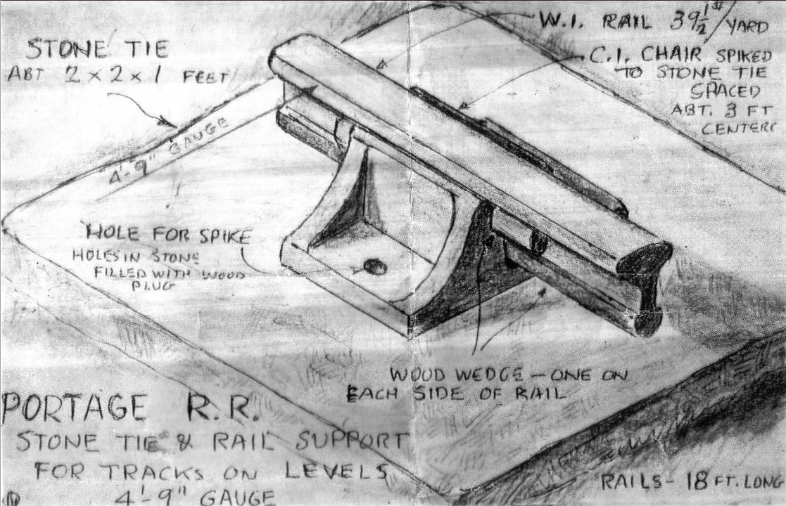
BTW, the drawing of the sleeper and rail comes from the Allegheny Portage RR,
they photo-shopped the Portage RR stuff and credit out, see below....
Photo by Pete Bannan/Merion
You can stop by Merion Station PA, and see eight of the stones on display at the
Merion Friends Meetinghouse.
GPS Coordinates: 40.00965, -75.25440
615 Montgomery Ave, Merion Station, PA 19066
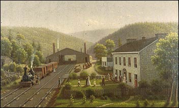
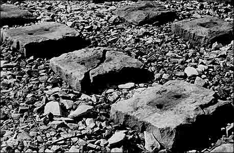
The Allegheny Portage Railroad, between Altoona and Johnstown PA used sleepers
extensively. The museum in Portage PA has an extremely well done exhibit,
and has laid out several hundred feet of the sleepers on the ground to give the
visitor an idea of how they were used.
The painting is nice, but the sleepers are too far apart!
(From the State Museum of Pennsylvania, Pennsylvania Historical and Museum Commission)
Close-up of the Allegheny Portage RR sleepers.
(From the Allegheny Portage National Historic Site)
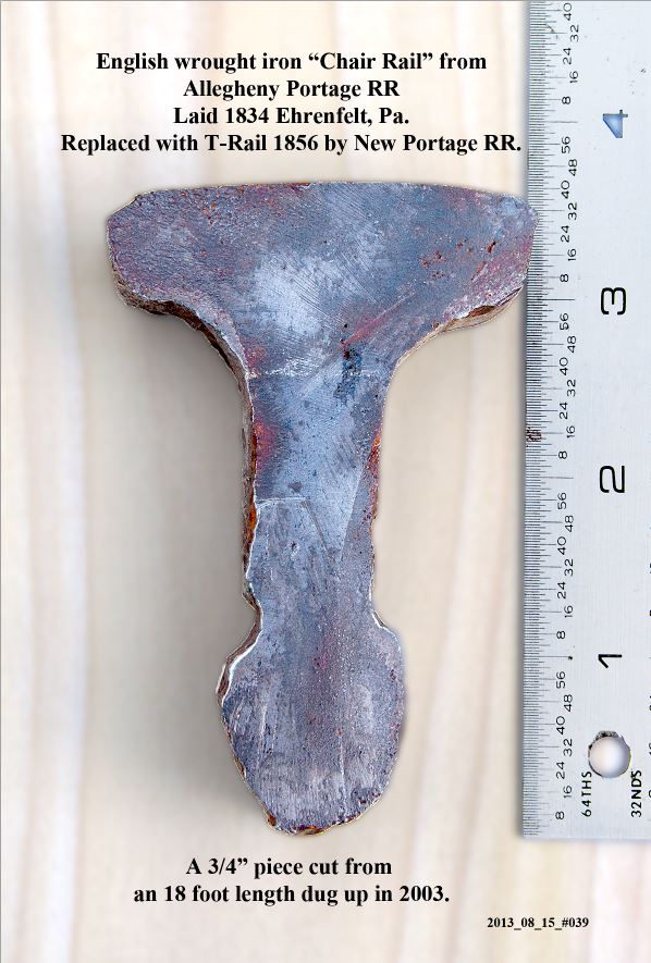
Below, photos of the original rail used on the Portage Railroad, dug up in 2003. Thanks to Abram for passing these along to me.
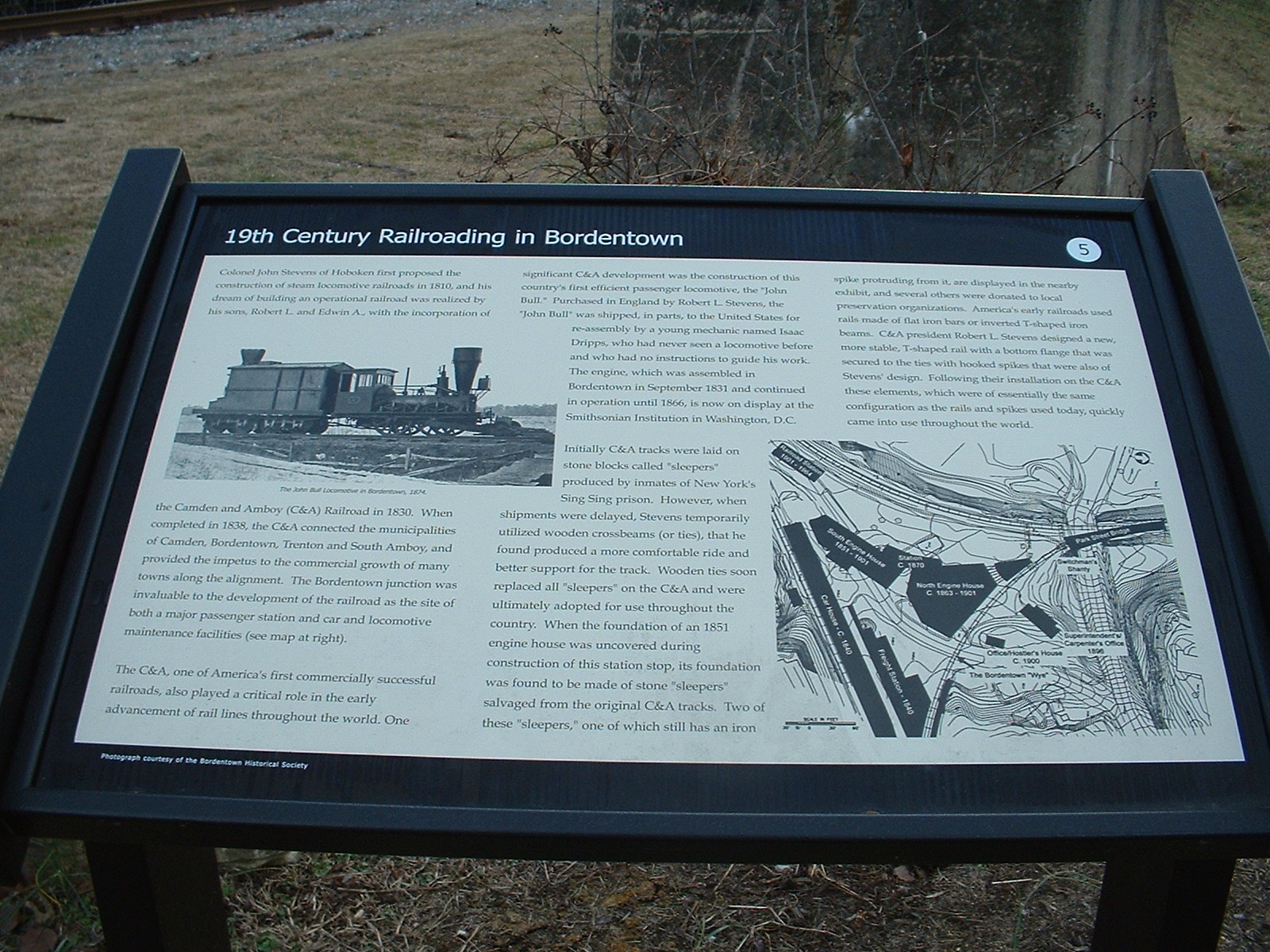
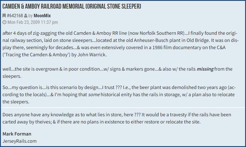
The C&A was incorporated in 1830 by Colonel
John Stevens (of Hoboken), and
completed in 1838 connecting Camden, Bordentown, Trenton, and South Amboy.
When they first started laying track, they used stone sleepers, made by the
inmates of Sing Sing prison. Once,
when the arrival of the sleepers was delayed, the Stevens' decided to
temporarily use wooden crossbeams, or ties. They soon found that the
trains ran smoother on the ties, and started to replace them.
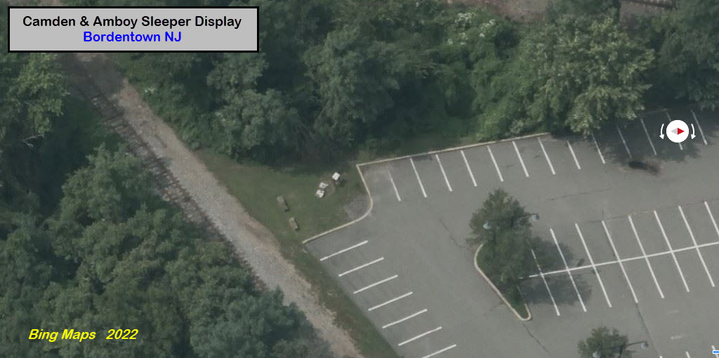
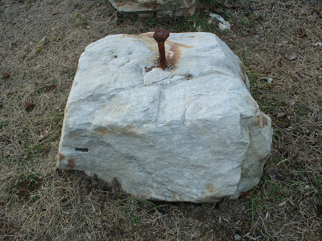
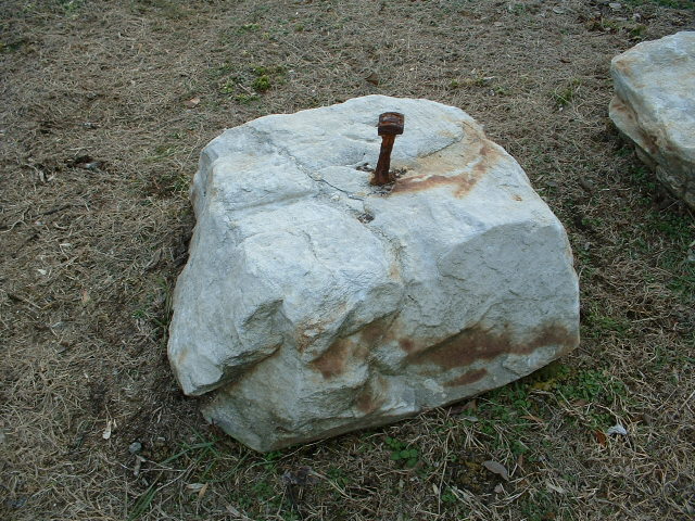
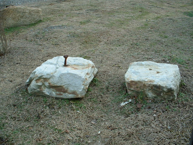
During the construction of the light
rail station in Bordentown, they uncovered the foundation of an old 1851 engine
house. They also discovered that the railroad used the old stone sleepers
for construction of the foundation. They have left a couple of them on
display in the middle of the wye with the marker shown below.
Colonel Stevens had two sons, Robert L. Stevens
and Edwin A. Stevens. Robert was
the one who went to England to purchase their first steam engine, the
John Bull, in 1831. The
engine ran until 1866, and is now on display in the Smithsonian.
On display in Bordentown NJ:
GPS Coordinates: 40.14676, -74.71586
The display is set up in the corner of the parking lot the middle of the wye, adjacent to the Light Rail Station.
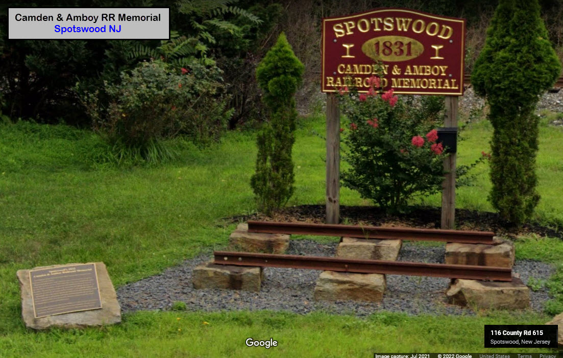
On display in Spotswood NJ:
GPS Coordinates: 40.40291, -74.37884
On Main St, slightly less than 1 mile SW from NJ 18.
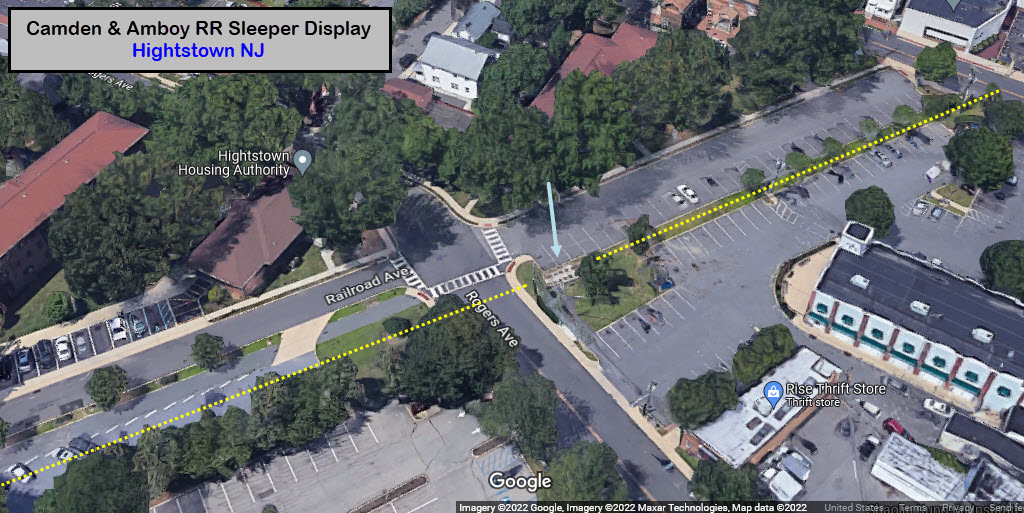
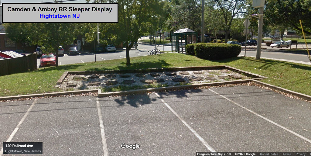
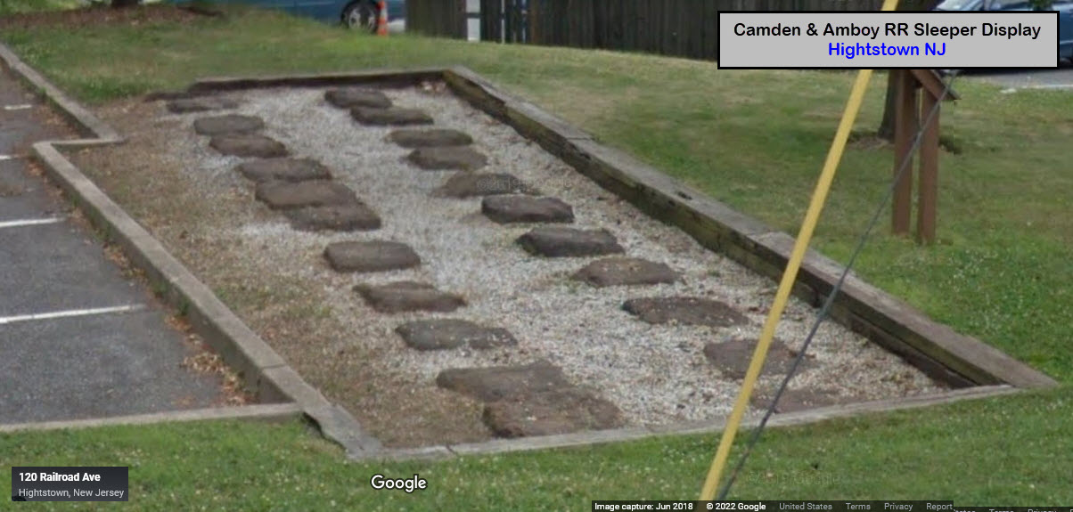
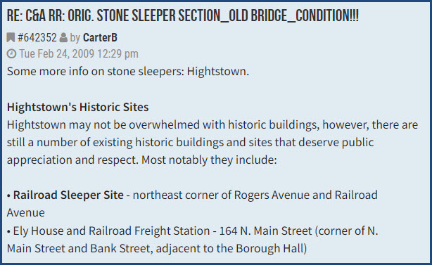
On display in Hightstown NJ:
GPS Coordinates: 40.26939, -74.52483
At the corner of Railroad and Rogers Avenues, placed on the original right-of-way.
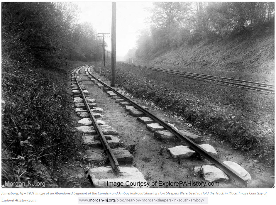
Formerly on display in Jamesburg NJ / 1931:
Additionally:
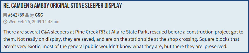
Here are a couple of notes from a 2009 thread on the C&A Sleepers, keep in
mind the info is 13 years old....
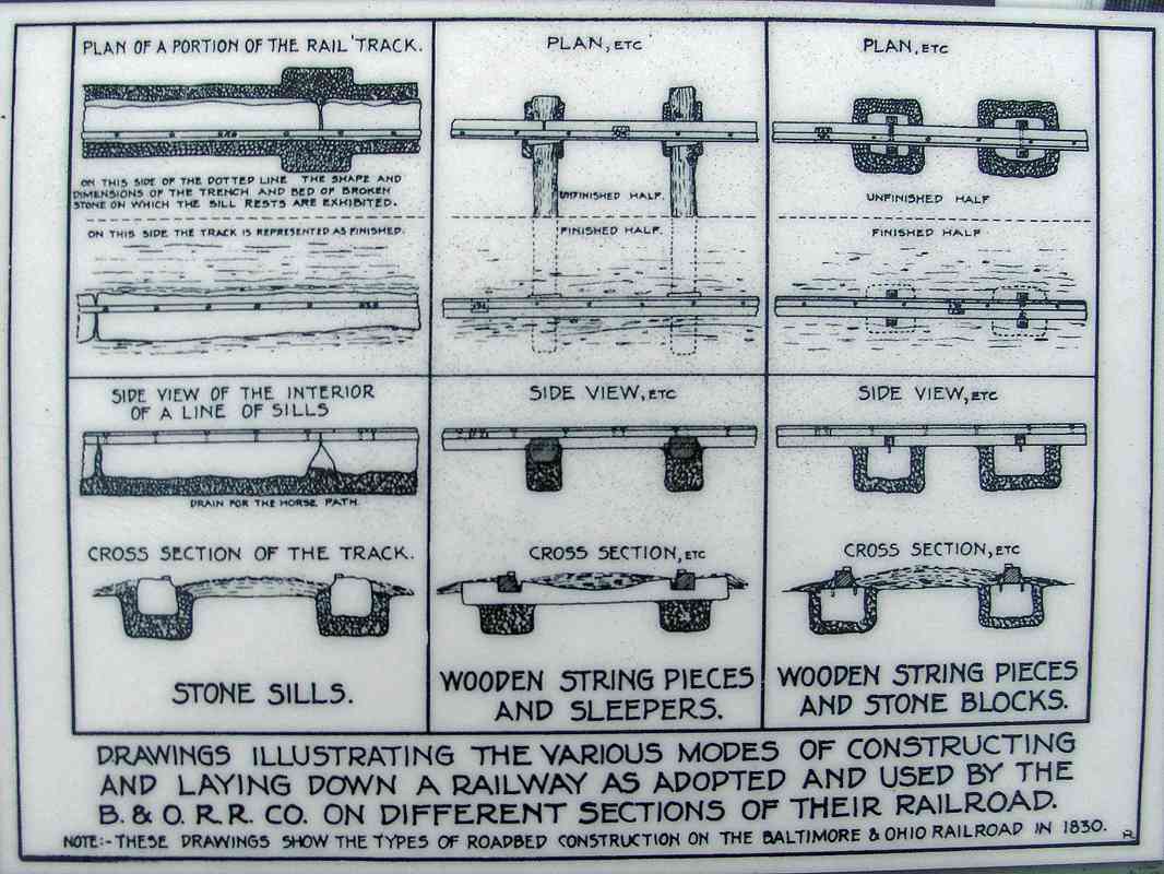
The B&O is generally credited with being the first to use granite stones as
support for rails, beginning in 1830. There is a whole lot more
information and pictures on Steve's excellently done page on the Old Main Line
sleepers. The pictures below are by
Steve Okonski, and the drawing comes from Dave Hiteshew.
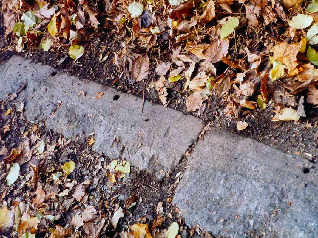
In addition to blocks the approximate size of the first four railroads I've
covered, the B&O also used a continuously supported method of construction,
where the stones were three or four times as long, and placed end to end.
This gave the rail basically 100% support. This is evidenced by the
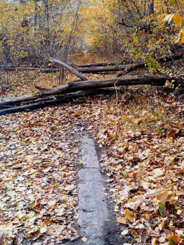
remaining sleepers still in the ground as you walk the path. In
addition, if you are observant, you will find where they used the sleepers
for other purposes once they started rebuilding the Old Main Line with
wooden ties - mostly in things like culverts.
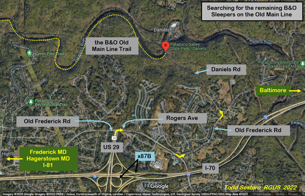
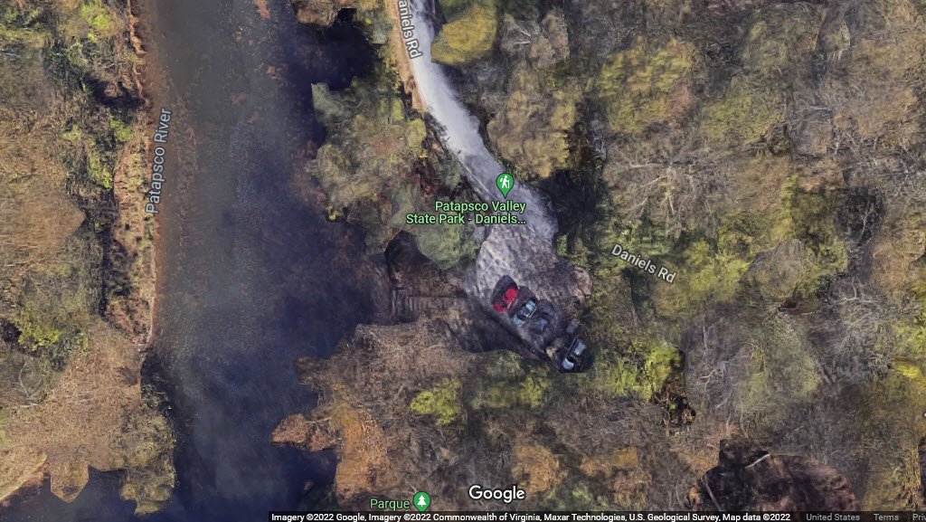
If you want to see the B&O sleepers for yourself, you can talk a walk
through the Patapsco State Park trail off of Daniels Rd in Daniels MD.
GPS Coordinates for the trail parking are 39.31377, -76.81564.
Historic Society of Baltimore County
If you plan to visit the HSBC, they have a really small window of opportunity to do so,
being open only on Fridays and Saturdays between 10am and 2pm!
9811 Van Buren Lane, Cockeysville MD 21030
Phone: 410-666-1878
Email: info@hsobc.org
Entrance Fee: Adults are $10.00 per visit, Members are free.
Holidays: The Historical Society is closed for New Year’s Day, Martin
Luther King, Jr.’s Birthday, President’s day, Memorial Day, Independence
Day/Fourth of July, Labor Day, Thanksgiving and Winter Holidays. (If a
holiday falls on a Sunday/Monday, HSBC is closed the Saturday prior.)
Directions: The HSBC is located (kinda) on top of the hill behind the Cockeysville Library on
Van Buren Lane, just off Padonia Road. From I-83, take exit 17
(Padonia Road) and head east. Go through the York Road intersection. At the next light at Greenside
Drive, turn left. Turn right onto the first street, Gibbons Boulevard. On your way up the
hill, turn left on to Van Buren Lane and proceed to the Almshouse.
Adam Youssi of the HSBC
Disclaimers:
New format 10/26/23: Please check out my disclaimer page for my standard
dribble and contact info here


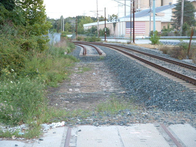
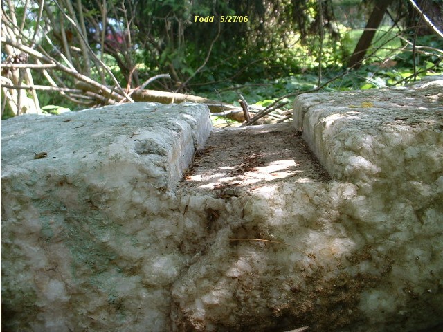
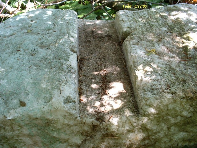
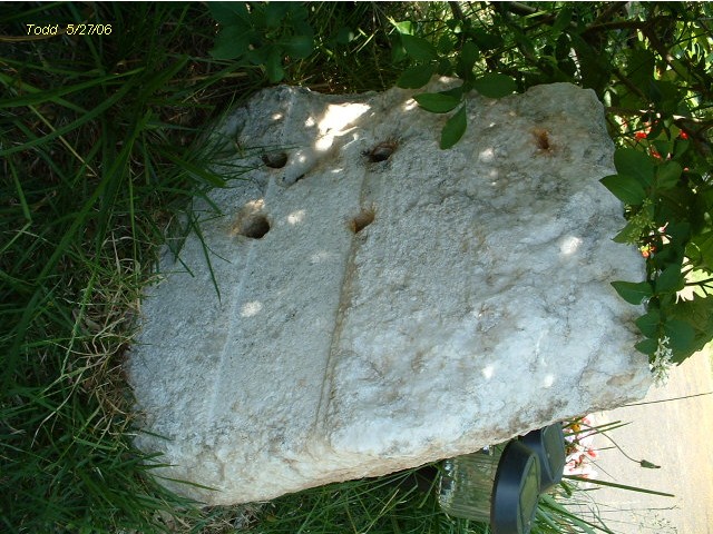
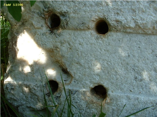
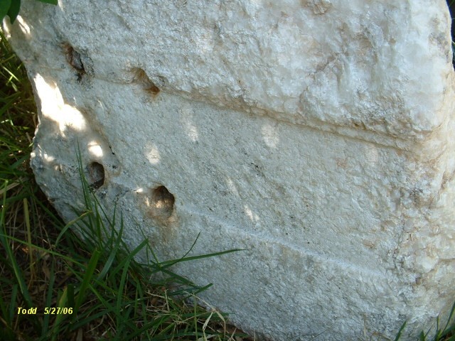
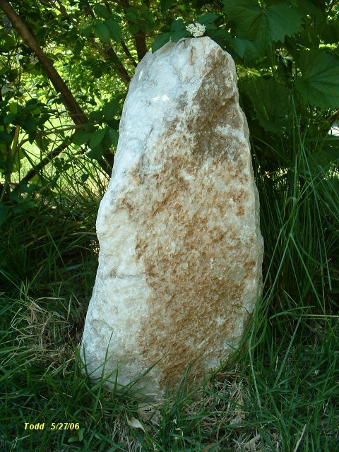
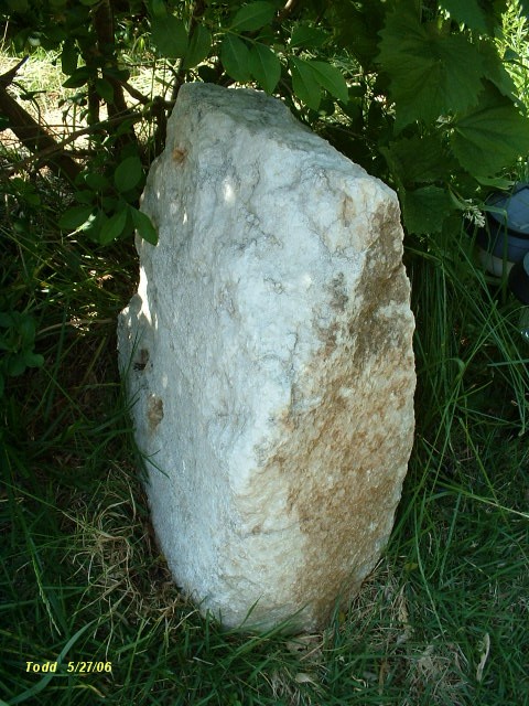

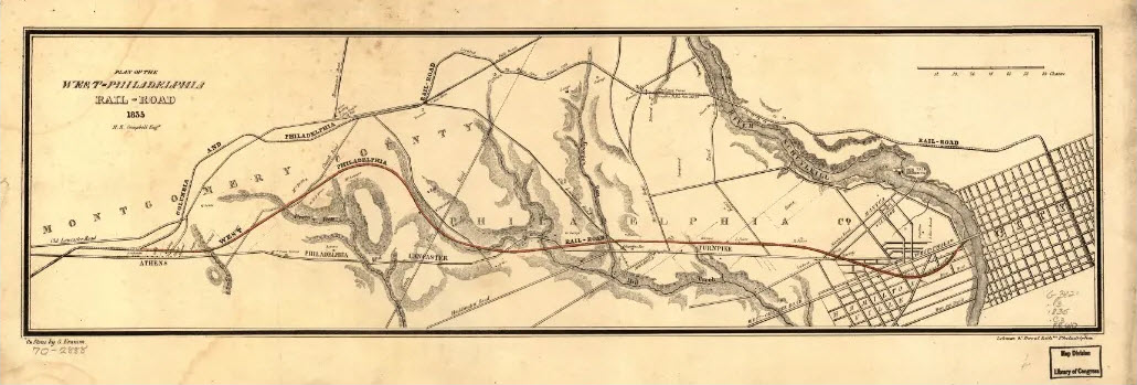

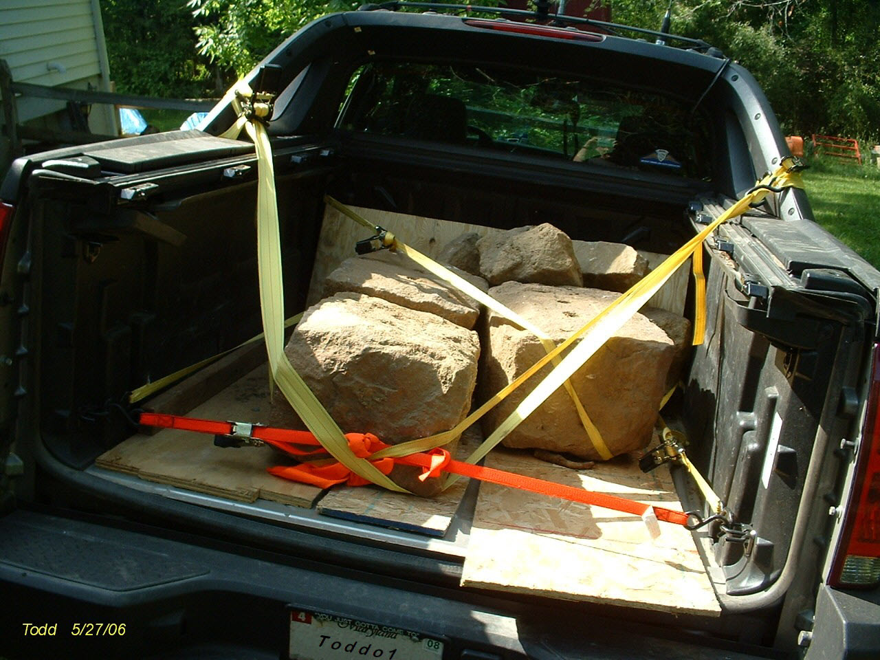
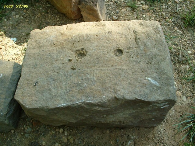
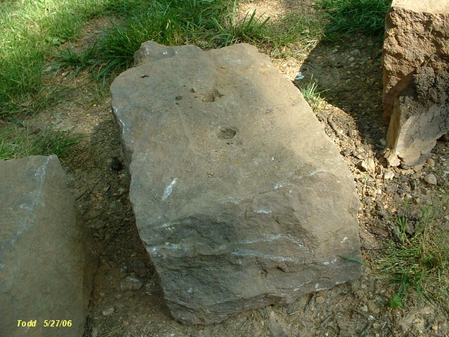
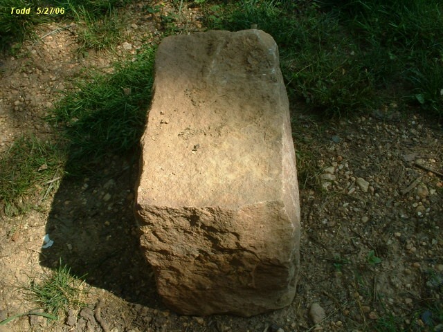
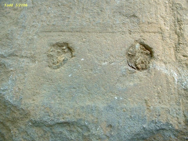
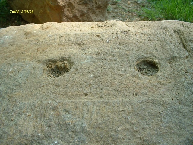
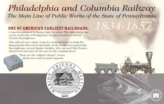
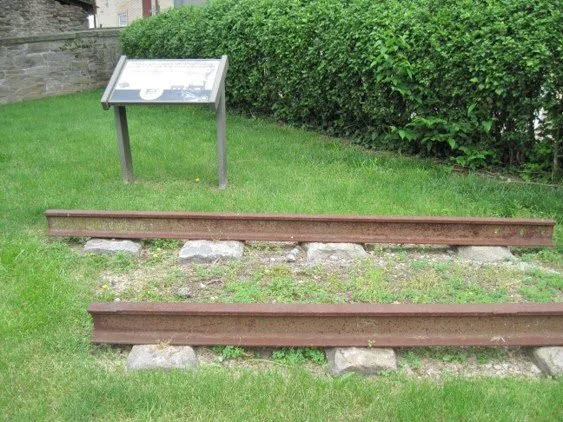
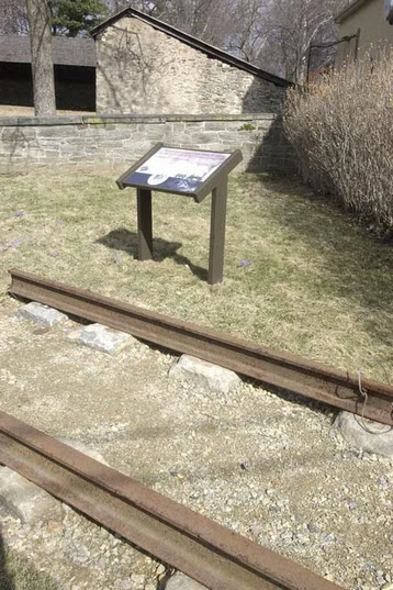 Photo by Pete Bannan/Merion
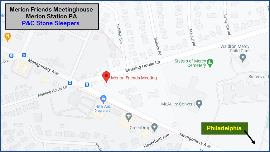

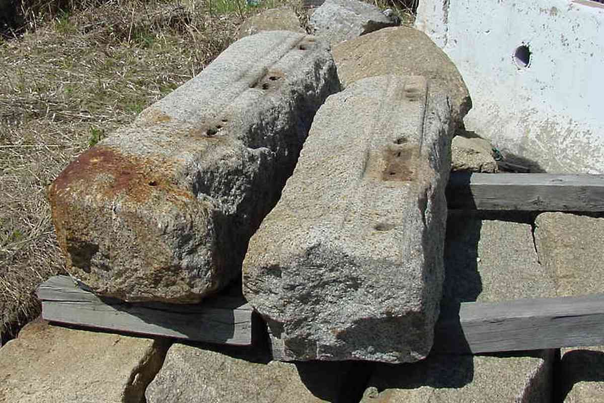

 Adam Youssi of the HSBC